San Sebastián de los Ballesteros geodata
San Sebastián de los Ballesteros (Andalusia) is a seat of a third-order administrative division; located in Spain in Europe/Madrid (GMT+2) time zone. With population of 869 people, there are 3106 cities with bigger population in this country. Compared to other cities in Spain, 90.4% of cities are located further ↑North; 69.9% of cities are located further →East and 74.2% of cities have higher elevation than San Sebastián de los Ballesteros. Note1
Administrative division(s):
- Level 1: Andalusia
- Level 2: Province of Córdoba
- Level 3: San Sebastián de los Ballesteros
Current local time in San Sebastián de los Ballesteros:
10:42 PM, ThursdayDifference from your time zone: hours


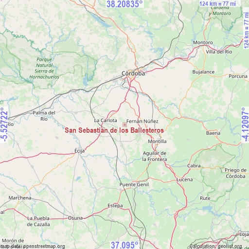
San Sebastián de los Ballesteros GPS coordinates[2]
37° 39' 13.536" North, 4° 49' 26.724" West
| Map corner | latitude | longitude |
|---|---|---|
| Upper-left | 38.20835°, | -5.52722° |
| Center: | 37.65376°, | -4.82409° |
| Lower-right: | 37.095°, | -4.12097° |
| Map W x H: | 123.8×123.8 km | = 76.9×76.9mi |
| max Lat: | 43.74134° ⇑90.4% North |
| San Sebastián de los Ballesteros: | 37.65376° |
| min Lat: | ⇓9.6% South 27.64134° |
| min Long | San Sebastián | max Long |
| -18.00367° | -4.82409° | 4.2899° |
| W 30.1%⇐ | ⇒69.9% E |
Elevation
Elevation of San Sebastián de los Ballesteros is 310 m = 1017 ft, and this is 288 m = 945 ft below average elevation for this country.
| Max E: |
1682 m = 5518 ft | 74.2% |
| Avg. | 598 m = 1962 ft | |
| San Sebastián de los Ballesteros | 310 m = 1017 ft | |
Min E: |
0 m = 0 ft | 25.8% |
See also: Spain elevation on elevation.city.
Geographical zone
San Sebastián de los Ballesteros is located in North temperate zone (between Tropic of Cancer and the Arctic Circle). Distance of this Northern Tropic circle is 1580.8 km =982.3 mi to South.| Distance of | km | miles | from San Sebastián de los Ballesteros |
|---|---|---|---|
| North Pole | 5820.4 | 3616.6 | to North |
| Arctic Circle | 3214.5 | 1997.4 | to North |
| Tropic Cancer | 1580.8 | 982.3 | to South |
| Equator | 4186.7 | 2601.5 | to South |


Nearby cities:
15 places around San Sebastián de los Ballesteros: (largest is in red/bold)
• Aguilar
21.3 km =13.2 mi,  136°
136°
• Almodóvar del Río
24.5 km =15.2 mi,  315°
315°
• Espejo
24 km =14.9 mi,  83°
83°
• Fernán-Núñez
8.8 km =5.5 mi, 77°
• Fuente Palmera
24.9 km =15.5 mi,  283°
283°
• Guadalcázar
15.6 km =9.7 mi, 317°
• La Carlota
9.7 km =6 mi, 283°
• La Rambla
9 km =5.6 mi,  124°
124°
• La Victoria
3.9 km =2.4 mi, 321°
• Montalbán de Córdoba
10.5 km =6.5 mi, 141°
• Montemayor
11.1 km =6.9 mi,  93°
93°
• Montilla
18 km =11.2 mi,  114°
114°
• Santaella
10.2 km =6.3 mi,  189°
189°
• Villarrubia
22.8 km =14.2 mi,  342°
342°
• Écija
25.9 km =16.1 mi,  241°
241°
Sources, notices
• [Note1] Compared only with cities in Spain existing in our database
• [Src1] Map data: © OpenStreetMap contributors (CC-BY-SA)
• [Src2] Other city data from geonames.org with taken over terms of usage.
• [Src3] Geographical zone / Annual Mean Temperature by Robert A. Rohde @ Wikipedia
