San Pedro de Mérida geodata
San Pedro de Mérida (Extremadura) is a seat of a third-order administrative division; located in Spain in Europe/Madrid (GMT+2) time zone. With population of 791 people, there are 3230 cities with bigger population in this country. Compared to other cities in Spain, 81.5% of cities are located further ↑North; 88.4% of cities are located further →East and 75.6% of cities have higher elevation than San Pedro de Mérida. Note1
Administrative division(s):
- Level 1: Extremadura
- Level 2: Provincia de Badajoz
- Level 3: San Pedro de Mérida


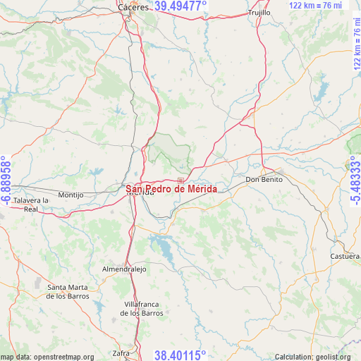
San Pedro de Mérida GPS coordinates[2]
38° 57' 0.252" North, 6° 11' 11.22" West
| Map corner | latitude | longitude |
|---|---|---|
| Upper-left | 39.49477°, | -6.88958° |
| Center: | 38.95007°, | -6.18645° |
| Lower-right: | 38.40115°, | -5.48333° |
| Map W x H: | 121.6×121.6 km | = 75.6×75.6mi |
| max Lat: | 43.74134° ⇑81.5% North |
| San Pedro de Mérida: | 38.95007° |
| min Lat: | ⇓18.5% South 27.64134° |
| min Long | San Pedro de M� | max Long |
| -18.00367° | -6.18645° | 4.2899° |
| W 11.6%⇐ | ⇒88.4% E |
Elevation
Elevation of San Pedro de Mérida is 290 m = 951 ft, and this is 308 m = 1010 ft below average elevation for this country.
| Max E: |
1682 m = 5518 ft | 75.6% |
| Avg. | 598 m = 1962 ft | |
| San Pedro de Mérida | 290 m = 951 ft | |
Min E: |
0 m = 0 ft | 24.4% |
See also: Spain elevation on elevation.city.
Geographical zone
San Pedro de Mérida is located in North temperate zone (between Tropic of Cancer and the Arctic Circle). Distance of this Northern Tropic circle is 1724.9 km =1071.8 mi to South.| Distance of | km | miles | from San Pedro de Mérida |
|---|---|---|---|
| North Pole | 5676.2 | 3527 | to North |
| Arctic Circle | 3070.3 | 1907.8 | to North |
| Tropic Cancer | 1724.9 | 1071.8 | to South |
| Equator | 4330.8 | 2691 | to South |


Nearby cities:
15 places around San Pedro de Mérida: (largest is in red/bold)
• Alange
19.1 km =11.9 mi,  195°
195°
• Aljucén
16.3 km =10.1 mi,  309°
309°
• Calamonte
18.7 km =11.6 mi,  248°
248°
• Cristina
14.6 km =9.1 mi,  148°
148°
• Don Álvaro
13.6 km =8.5 mi,  214°
214°
• Guareña
12.5 km =7.8 mi,  143°
143°
• Mirandilla
10.6 km =6.6 mi,  303°
303°
• Mérida
14.1 km =8.8 mi, 254°
• Oliva de Mérida
18.5 km =11.5 mi,  163°
163°
• Santa Amalia
16.6 km =10.3 mi,  65°
65°
• Trujillanos
6.2 km =3.9 mi,  272°
272°
• Valdetorres
11 km =6.8 mi,  110°
110°
• Valverde de Mérida
5.2 km =3.2 mi, 213°
• Villagonzalo
9.7 km =6 mi,  185°
185°
• Zarza de Alange
14.9 km =9.3 mi, 190°
Sources, notices
• [Note1] Compared only with cities in Spain existing in our database
• [Src1] Map data: © OpenStreetMap contributors (CC-BY-SA)
• [Src2] Other city data from geonames.org with taken over terms of usage.
• [Src3] Geographical zone / Annual Mean Temperature by Robert A. Rohde @ Wikipedia
