Guareña geodata
Guareña (Extremadura) is a populated place; located in Spain in Europe/Madrid (GMT+2) time zone. With population of 7,330 people, there are 1002 cities with bigger population in this country. Compared to other cities in Spain, 82.5% of cities are located further ↑North; 87.4% of cities are located further →East and 76.3% of cities have higher elevation than Guareña. Note1
Administrative division(s):
- Level 1: Extremadura
- Level 2: Provincia de Badajoz
- Level 3: Oliva de Mérida


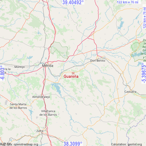
Guareña GPS coordinates[2]
38° 51' 34.272" North, 6° 5' 59.532" West
| Map corner | latitude | longitude |
|---|---|---|
| Upper-left | 39.40492°, | -6.803° |
| Center: | 38.85952°, | -6.09987° |
| Lower-right: | 38.3099°, | -5.39675° |
| Map W x H: | 121.8×121.8 km | = 75.7×75.7mi |
| max Lat: | 43.74134° ⇑82.5% North |
| Guareña: | 38.85952° |
| min Lat: | ⇓17.5% South 27.64134° |
| min Long | Guareña | max Long |
| -18.00367° | -6.09987° | 4.2899° |
| W 12.6%⇐ | ⇒87.4% E |
Elevation
Elevation of Guareña is 281 m = 922 ft, and this is 317 m = 1040 ft below average elevation for this country.
| Max E: |
1682 m = 5518 ft | 76.3% |
| Avg. | 598 m = 1962 ft | |
| Guareña | 281 m = 922 ft | |
Min E: |
0 m = 0 ft | 23.7% |
See also: Spain elevation on elevation.city.
Geographical zone
Guareña is located in North temperate zone (between Tropic of Cancer and the Arctic Circle). Distance of this Northern Tropic circle is 1714.9 km =1065.6 mi to South.| Distance of | km | miles | from Guareña |
|---|---|---|---|
| North Pole | 5686.3 | 3533.3 | to North |
| Arctic Circle | 3080.4 | 1914.1 | to North |
| Tropic Cancer | 1714.9 | 1065.6 | to South |
| Equator | 4320.8 | 2684.8 | to South |


Nearby cities:
15 places around Guareña: (largest is in red/bold)
• Alange
15.1 km =9.4 mi,  236°
236°
• Cristina
2.5 km =1.6 mi,  177°
177°
• Don Álvaro
15.2 km =9.4 mi,  265°
265°
• Manchita
8.5 km =5.3 mi,  126°
126°
• Medellín
16.8 km =10.4 mi,  46°
46°
• Mengabril
16.7 km =10.4 mi,  59°
59°
• Oliva de Mérida
8 km =5 mi,  195°
195°
• Palomas
18.8 km =11.7 mi,  189°
189°
• San Pedro de Mérida
12.5 km =7.8 mi,  323°
323°
• Santa Amalia
18.5 km =11.5 mi,  24°
24°
• Trujillanos
17.1 km =10.6 mi,  307°
307°
• Valdetorres
6.8 km =4.2 mi, 24°
• Valverde de Mérida
11.9 km =7.4 mi,  298°
298°
• Villagonzalo
8.4 km =5.2 mi, 272°
• Zarza de Alange
11.2 km =7 mi,  245°
245°
Sources, notices
• [Note1] Compared only with cities in Spain existing in our database
• [Src1] Map data: © OpenStreetMap contributors (CC-BY-SA)
• [Src2] Other city data from geonames.org with taken over terms of usage.
• [Src3] Geographical zone / Annual Mean Temperature by Robert A. Rohde @ Wikipedia
