Sant Lluís geodata
Sant Lluís (Balearic Islands) is a seat of a third-order administrative division; located in Spain in Europe/Madrid (GMT+2) time zone. With population of 5,865 people, there are 1152 cities with bigger population in this country. Compared to other cities in Spain, 72.4% of cities are located further ↑North; 100% of cities are located further ←West and 90.4% of cities have higher elevation than Sant Lluís. Note1


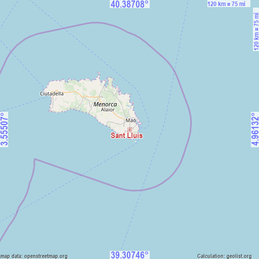
Sant Lluís GPS coordinates[2]
39° 50' 57.804" North, 4° 15' 29.484" East
| Map corner | latitude | longitude |
|---|---|---|
| Upper-left | 40.38708°, | 3.55507° |
| Center: | 39.84939°, | 4.25819° |
| Lower-right: | 39.30746°, | 4.96132° |
| Map W x H: | 120×120 km | = 74.6×74.6mi |
| max Lat: | 43.74134° ⇑72.4% North |
| Sant Lluís: | 39.84939° |
| min Lat: | ⇓27.6% South 27.64134° |
| min Long | Sant Lluís | max Long |
| -18.00367° | 4.25819° | 4.2899° |
| W 100%⇐ | ⇒0% E |
Elevation
Elevation of Sant Lluís is 60 m = 197 ft, and this is 538 m = 1765 ft below average elevation for this country.
| Max E: |
1682 m = 5518 ft | 90.4% |
| Avg. | 598 m = 1962 ft | |
| Sant Lluís | 60 m = 197 ft | |
Min E: |
0 m = 0 ft | 9.6% |
See also: Spain elevation on elevation.city.
Geographical zone
Sant Lluís is located in North temperate zone (between Tropic of Cancer and the Arctic Circle). Distance of this Northern Tropic circle is 1824.9 km =1133.9 mi to South.| Distance of | km | miles | from Sant Lluís |
|---|---|---|---|
| North Pole | 5576.2 | 3464.9 | to North |
| Arctic Circle | 2970.3 | 1845.7 | to North |
| Tropic Cancer | 1824.9 | 1133.9 | to South |
| Equator | 4430.8 | 2753.2 | to South |


Nearby cities:
15 places around Sant Lluís: (largest is in red/bold)
• Alaior
13.5 km =8.4 mi,  311°
311°
• Artà
79.6 km =49.5 mi,  257°
257°
• Cala Rajada
69.6 km =43.2 mi, 257°
• Can Picafort
94.7 km =58.8 mi, 264°
• Capdepera
72.2 km =44.9 mi, 256°
• Ciutadella
39.3 km =24.4 mi,  295°
295°
• Es Castell
4.1 km =2.5 mi,  40°
40°
• Es Migjorn Gran
20.7 km =12.9 mi, 301°
• Ferreries
25.7 km =16 mi, 305°
• Manacor
94.9 km =59 mi,  250°
250°
• Maó
4.4 km =2.7 mi,  8°
8°
• Mercadal
21 km =13 mi,  318°
318°
• Porto Cristo
86.3 km =53.6 mi, 246°
• Sant Llorenç des Cardassar
87.5 km =54.4 mi, 252°
• Son Servera
80.9 km =50.3 mi, 251°
Sources, notices
• [Note1] Compared only with cities in Spain existing in our database
• [Src1] Map data: © OpenStreetMap contributors (CC-BY-SA)
• [Src2] Other city data from geonames.org with taken over terms of usage.
• [Src3] Geographical zone / Annual Mean Temperature by Robert A. Rohde @ Wikipedia
