Puebla de Don Fadrique geodata
Puebla de Don Fadrique (Andalusia) is a seat of a third-order administrative division; located in Spain in Europe/Madrid (GMT+2) time zone. In our database, there are 6762 cities with bigger population. Compared to other cities in Spain, 88.9% of cities are located further ↑North; 61.7% of cities are located further ←West and 96.7% of cities have lower elevation than Puebla de Don Fadrique. Note1
Administrative division(s):
- Level 1: Andalusia
- Level 2: Provincia de Granada
- Level 3: Puebla de Don Fadrique
Current local time in Puebla de Don Fadrique:
11:55 PM, ThursdayDifference from your time zone: hours


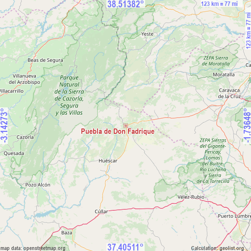
Puebla de Don Fadrique GPS coordinates[2]
37° 57' 41.616" North, 2° 26' 22.596" West
| Map corner | latitude | longitude |
|---|---|---|
| Upper-left | 38.51382°, | -3.14273° |
| Center: | 37.96156°, | -2.43961° |
| Lower-right: | 37.40511°, | -1.73648° |
| Map W x H: | 123.3×123.3 km | = 76.6×76.6mi |
| max Lat: | 43.74134° ⇑88.9% North |
| Puebla de Don Fadrique: | 37.96156° |
| min Lat: | ⇓11.1% South 27.64134° |
| min Long | Puebla de Don F | max Long |
| -18.00367° | -2.43961° | 4.2899° |
| W 61.7%⇐ | ⇒38.3% E |
Elevation
Elevation of Puebla de Don Fadrique is 1196 m = 3924 ft, and this is 598 m = 1962 ft above average elevation for this country.
| Max E: |
1682 m = 5518 ft | 3.3% |
| Puebla de Don Fadrique | 1196 m 3924 ft | |
| Avg. | 598 m = 1962 ft | |
Min E: |
0 m = 0 ft | 96.7% |
See also: Spain elevation on elevation.city.
Geographical zone
Puebla de Don Fadrique is located in North temperate zone (between Tropic of Cancer and the Arctic Circle). Distance of this Northern Tropic circle is 1615 km =1003.5 mi to South.| Distance of | km | miles | from Puebla de Don Fadrique |
|---|---|---|---|
| North Pole | 5786.1 | 3595.3 | to North |
| Arctic Circle | 3180.2 | 1976.1 | to North |
| Tropic Cancer | 1615 | 1003.5 | to South |
| Equator | 4220.9 | 2622.7 | to South |


Nearby cities:
15 places around Puebla de Don Fadrique: (largest is in red/bold)
• Benamaurel
45.6 km =28.3 mi,  210°
210°
• Castilléjar
32.4 km =20.1 mi, 212°
• Castril
35.1 km =21.8 mi,  238°
238°
• Chirivel
43.4 km =27 mi,  159°
159°
• Cortes de Baza
44.9 km =27.9 mi,  220°
220°
• Galera
26.3 km =16.3 mi,  202°
202°
• Huéscar
19 km =11.8 mi, 208°
• María
36.9 km =22.9 mi,  139°
139°
• Nerpio
23.9 km =14.9 mi,  30°
30°
• Orce
26.9 km =16.7 mi,  187°
187°
• Orcera
44.2 km =27.5 mi,  333°
333°
• Segura de la Sierra
41.8 km =26 mi, 333°
• Velez Rubio
47.2 km =29.3 mi, 137°
• Vélez-Blanco
42.6 km =26.5 mi,  134°
134°
• Yeste
46.5 km =28.9 mi,  13°
13°
Sources, notices
• [Note1] Compared only with cities in Spain existing in our database
• [Src1] Map data: © OpenStreetMap contributors (CC-BY-SA)
• [Src2] Other city data from geonames.org with taken over terms of usage.
• [Src3] Geographical zone / Annual Mean Temperature by Robert A. Rohde @ Wikipedia
