Los Palacios y Villafranca geodata
Los Palacios y Villafranca (Andalusia) is a populated place; located in Spain in Europe/Madrid (GMT+2) time zone. With population of 36,824 people, there are 242 cities with bigger population in this country. Compared to other cities in Spain, 94.4% of cities are located further ↑North; 85.1% of cities are located further →East and 97.6% of cities have higher elevation than Los Palacios y Villafranca. Note1
Administrative division(s):
- Level 1: Andalusia
- Level 2: Provincia de Sevilla
- Level 3: Palacios y Villafranca, Los
Current local time in Los Palacios y Villafranca:
09:43 PM, ThursdayDifference from your time zone: hours


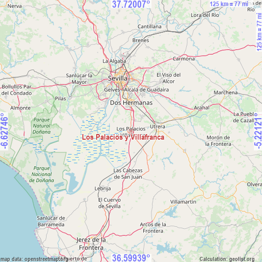
Los Palacios y Villafranca GPS coordinates[2]
37° 9' 42.516" North, 5° 55' 27.588" West
| Map corner | latitude | longitude |
|---|---|---|
| Upper-left | 37.72007°, | -6.62746° |
| Center: | 37.16181°, | -5.92433° |
| Lower-right: | 36.59939°, | -5.22121° |
| Map W x H: | 124.6×124.6 km | = 77.4×77.4mi |
| max Lat: | 43.74134° ⇑94.4% North |
| Los Palacios y Villafranca: | 37.16181° |
| min Lat: | ⇓5.6% South 27.64134° |
| min Long | Los Palacios y | max Long |
| -18.00367° | -5.92433° | 4.2899° |
| W 14.9%⇐ | ⇒85.1% E |
Elevation
Elevation of Los Palacios y Villafranca is 13 m = 43 ft, and this is 585 m = 1919 ft below average elevation for this country.
| Max E: |
1682 m = 5518 ft | 97.6% |
| Avg. | 598 m = 1962 ft | |
| Los Palacios y Villafranca | 13 m = 43 ft | |
Min E: |
0 m = 0 ft | 2.4% |
See also: Spain elevation on elevation.city.
Geographical zone
Los Palacios y Villafranca is located in North temperate zone (between Tropic of Cancer and the Arctic Circle). Distance of this Northern Tropic circle is 1526.1 km =948.3 mi to South.| Distance of | km | miles | from Los Palacios y Villafranca |
|---|---|---|---|
| North Pole | 5875.1 | 3650.6 | to North |
| Arctic Circle | 3269.2 | 2031.4 | to North |
| Tropic Cancer | 1526.1 | 948.3 | to South |
| Equator | 4132 | 2567.5 | to South |


Nearby cities:
15 places around Los Palacios y Villafranca: (largest is in red/bold)
• Alcalá de Guadaira
21 km =13 mi,  20°
20°
• Almensilla
23.4 km =14.5 mi,  315°
315°
• Bormujos
26.9 km =16.7 mi,  330°
330°
• Coria del Río
18.1 km =11.2 mi, 320°
• Dos Hermanas
13.5 km =8.4 mi,  1°
1°
• Gelves
21.2 km =13.2 mi, 334°
• La Puebla del Río
17 km =10.6 mi,  313°
313°
• Las Cabezas de San Juan
19.8 km =12.3 mi,  183°
183°
• Los Molares
18.3 km =11.4 mi,  91°
91°
• Mairena del Aljarafe
23.8 km =14.8 mi, 328°
• Palomares del Río
21.4 km =13.3 mi, 326°
• San Juan de Aznalfarache
24 km =14.9 mi,  335°
335°
• Sevilla
25 km =15.5 mi,  350°
350°
• Tomares
25.8 km =16 mi, 335°
• Utrera
13 km =8.1 mi,  78°
78°
Sources, notices
• [Note1] Compared only with cities in Spain existing in our database
• [Src1] Map data: © OpenStreetMap contributors (CC-BY-SA)
• [Src2] Other city data from geonames.org with taken over terms of usage.
• [Src3] Geographical zone / Annual Mean Temperature by Robert A. Rohde @ Wikipedia
