Las Cabezas de San Juan geodata
Las Cabezas de San Juan (Andalusia) is a populated place; located in Spain in Europe/Madrid (GMT+2) time zone. With population of 16,464 people, there are 571 cities with bigger population in this country. Compared to other cities in Spain, 95.5% of cities are located further ↑North; 85.3% of cities are located further →East and 91.6% of cities have higher elevation than Las Cabezas de San Juan. Note1
Administrative division(s):
- Level 1: Andalusia
- Level 2: Provincia de Sevilla
- Level 3: Cabezas de San Juan, Las
Current local time in Las Cabezas de San Juan:
09:38 PM, ThursdayDifference from your time zone: hours


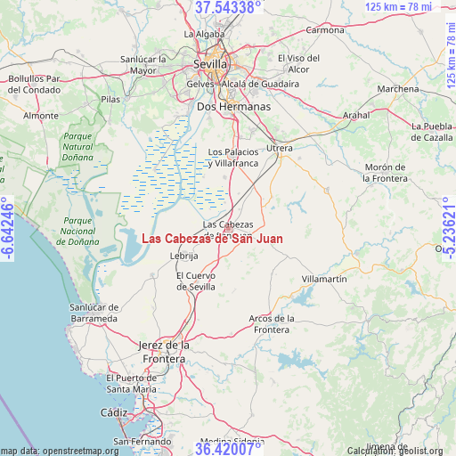
Las Cabezas de San Juan GPS coordinates[2]
36° 59' 1.68" North, 5° 56' 21.588" West
| Map corner | latitude | longitude |
|---|---|---|
| Upper-left | 37.54338°, | -6.64246° |
| Center: | 36.9838°, | -5.93933° |
| Lower-right: | 36.42007°, | -5.23621° |
| Map W x H: | 124.9×124.9 km | = 77.6×77.6mi |
| max Lat: | 43.74134° ⇑95.5% North |
| Las Cabezas de San Juan: | 36.9838° |
| min Lat: | ⇓4.5% South 27.64134° |
| min Long | Las Cabezas de | max Long |
| -18.00367° | -5.93933° | 4.2899° |
| W 14.7%⇐ | ⇒85.3% E |
Elevation
Elevation of Las Cabezas de San Juan is 46 m = 151 ft, and this is 552 m = 1811 ft below average elevation for this country.
| Max E: |
1682 m = 5518 ft | 91.6% |
| Avg. | 598 m = 1962 ft | |
| Las Cabezas de San Juan | 46 m = 151 ft | |
Min E: |
0 m = 0 ft | 8.4% |
See also: Spain elevation on elevation.city.
Geographical zone
Las Cabezas de San Juan is located in North temperate zone (between Tropic of Cancer and the Arctic Circle). Distance of this Northern Tropic circle is 1506.3 km =936 mi to South.| Distance of | km | miles | from Las Cabezas de San Juan |
|---|---|---|---|
| North Pole | 5894.8 | 3662.9 | to North |
| Arctic Circle | 3289 | 2043.7 | to North |
| Tropic Cancer | 1506.3 | 936 | to South |
| Equator | 4112.2 | 2555.2 | to South |


Nearby cities:
15 places around Las Cabezas de San Juan: (largest is in red/bold)
• Arcos de la Frontera
28.3 km =17.6 mi,  156°
156°
• Bornos
25.4 km =15.8 mi,  136°
136°
• Coria del Río
35.3 km =21.9 mi,  343°
343°
• Dos Hermanas
33.3 km =20.7 mi,  2°
2°
• El Coronil
29.1 km =18.1 mi,  68°
68°
• El Cuervo
17 km =10.6 mi,  211°
211°
• Espera
17 km =10.6 mi, 135°
• La Puebla del Río
33.4 km =20.8 mi, 340°
• Lebrija
14 km =8.7 mi,  239°
239°
• Los Molares
27.5 km =17.1 mi,  45°
45°
• Los Palacios y Villafranca
19.8 km =12.3 mi, 3°
• Montellano
32.7 km =20.3 mi,  87°
87°
• Trebujena
24.5 km =15.2 mi, 239°
• Utrera
26.4 km =16.4 mi,  32°
32°
• Villamartín
29.6 km =18.4 mi,  117°
117°
Sources, notices
• [Note1] Compared only with cities in Spain existing in our database
• [Src1] Map data: © OpenStreetMap contributors (CC-BY-SA)
• [Src2] Other city data from geonames.org with taken over terms of usage.
• [Src3] Geographical zone / Annual Mean Temperature by Robert A. Rohde @ Wikipedia
