Lora de Estepa geodata
Lora de Estepa (Andalusia) is a seat of a third-order administrative division; located in Spain in Europe/Madrid (GMT+2) time zone. With population of 815 people, there are 3183 cities with bigger population in this country. Compared to other cities in Spain, 93.2% of cities are located further ↑North; 70% of cities are located further →East and 66% of cities have higher elevation than Lora de Estepa. Note1
Administrative division(s):
- Level 1: Andalusia
- Level 2: Provincia de Sevilla
- Level 3: Lora de Estepa


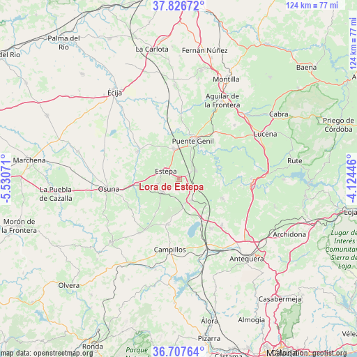
Lora de Estepa GPS coordinates[2]
37° 16' 9.336" North, 4° 49' 39.324" West
| Map corner | latitude | longitude |
|---|---|---|
| Upper-left | 37.82672°, | -5.53071° |
| Center: | 37.26926°, | -4.82759° |
| Lower-right: | 36.70764°, | -4.12446° |
| Map W x H: | 124.4×124.4 km | = 77.3×77.3mi |
| max Lat: | 43.74134° ⇑93.2% North |
| Lora de Estepa: | 37.26926° |
| min Lat: | ⇓6.8% South 27.64134° |
| min Long | Lora de Estepa | max Long |
| -18.00367° | -4.82759° | 4.2899° |
| W 30%⇐ | ⇒70% E |
Elevation
Elevation of Lora de Estepa is 446 m = 1463 ft, and this is 152 m = 499 ft below average elevation for this country.
| Max E: |
1682 m = 5518 ft | 66% |
| Avg. | 598 m = 1962 ft | |
| Lora de Estepa | 446 m = 1463 ft | |
Min E: |
0 m = 0 ft | 34% |
See also: Spain elevation on elevation.city.
Geographical zone
Lora de Estepa is located in North temperate zone (between Tropic of Cancer and the Arctic Circle). Distance of this Northern Tropic circle is 1538 km =955.7 mi to South.| Distance of | km | miles | from Lora de Estepa |
|---|---|---|---|
| North Pole | 5863.1 | 3643.2 | to North |
| Arctic Circle | 3257.2 | 2023.9 | to North |
| Tropic Cancer | 1538 | 955.7 | to South |
| Equator | 4144 | 2575 | to South |


Nearby cities:
15 places around Lora de Estepa: (largest is in red/bold)
• Aguadulce
14.7 km =9.1 mi,  262°
262°
• Alameda
16.4 km =10.2 mi,  114°
114°
• Badolatosa
14.3 km =8.9 mi,  72°
72°
• Casariche
6.6 km =4.1 mi, 65°
• El Rubio
17.2 km =10.7 mi,  304°
304°
• Estepa
5.2 km =3.2 mi, 299°
• Fuente de Piedra
17.2 km =10.7 mi,  149°
149°
• Gilena
7.9 km =4.9 mi, 255°
• Herrera
10.7 km =6.6 mi,  349°
349°
• Humilladero
20.5 km =12.7 mi, 147°
• La Roda de Andalucía
8.5 km =5.3 mi, 148°
• Marinaleda
16.3 km =10.1 mi,  314°
314°
• Pedrera
7.6 km =4.7 mi,  230°
230°
• Puente-Genil
14.4 km =8.9 mi,  21°
21°
• Sierra de Yeguas
16.5 km =10.3 mi,  192°
192°
Sources, notices
• [Note1] Compared only with cities in Spain existing in our database
• [Src1] Map data: © OpenStreetMap contributors (CC-BY-SA)
• [Src2] Other city data from geonames.org with taken over terms of usage.
• [Src3] Geographical zone / Annual Mean Temperature by Robert A. Rohde @ Wikipedia
