Gilena geodata
Gilena (Andalusia) is a seat of a third-order administrative division; located in Spain in Europe/Madrid (GMT+2) time zone. With population of 3,811 people, there are 1513 cities with bigger population in this country. Compared to other cities in Spain, 93.5% of cities are located further ↑North; 71.4% of cities are located further →East and 64.6% of cities have higher elevation than Gilena. Note1


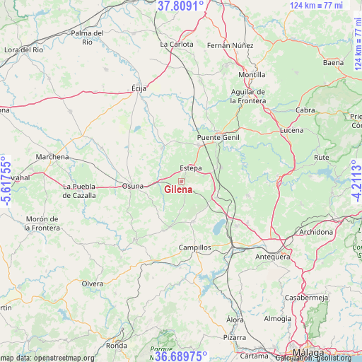
Gilena GPS coordinates[2]
37° 15' 5.4" North, 4° 54' 51.912" West
| Map corner | latitude | longitude |
|---|---|---|
| Upper-left | 37.8091°, | -5.61755° |
| Center: | 37.2515°, | -4.91442° |
| Lower-right: | 36.68975°, | -4.2113° |
| Map W x H: | 124.5×124.5 km | = 77.4×77.4mi |
| max Lat: | 43.74134° ⇑93.5% North |
| Gilena: | 37.2515° |
| min Lat: | ⇓6.5% South 27.64134° |
| min Long | Gilena | max Long |
| -18.00367° | -4.91442° | 4.2899° |
| W 28.6%⇐ | ⇒71.4% E |
Elevation
Elevation of Gilena is 465 m = 1526 ft, and this is 133 m = 436 ft below average elevation for this country.
| Max E: |
1682 m = 5518 ft | 64.6% |
| Avg. | 598 m = 1962 ft | |
| Gilena | 465 m = 1526 ft | |
Min E: |
0 m = 0 ft | 35.4% |
See also: Spain elevation on elevation.city.
Geographical zone
Gilena is located in North temperate zone (between Tropic of Cancer and the Arctic Circle). Distance of this Northern Tropic circle is 1536.1 km =954.5 mi to South.| Distance of | km | miles | from Gilena |
|---|---|---|---|
| North Pole | 5865.1 | 3644.4 | to North |
| Arctic Circle | 3259.2 | 2025.2 | to North |
| Tropic Cancer | 1536.1 | 954.5 | to South |
| Equator | 4142 | 2573.7 | to South |


Nearby cities:
15 places around Gilena: (largest is in red/bold)
• Aguadulce
6.9 km =4.3 mi,  271°
271°
• Casariche
14.5 km =9 mi,  70°
70°
• El Rubio
13.4 km =8.3 mi,  330°
330°
• Estepa
5.5 km =3.4 mi,  34°
34°
• Fuente de Piedra
20.8 km =12.9 mi,  128°
128°
• Herrera
13.7 km =8.5 mi,  24°
24°
• La Roda de Andalucía
13.2 km =8.2 mi,  113°
113°
• Lora de Estepa
7.9 km =4.9 mi,  75°
75°
• Los Corrales
18 km =11.2 mi,  200°
200°
• Marinaleda
13.9 km =8.6 mi,  343°
343°
• Martín de la Jara
16.5 km =10.3 mi, 195°
• Osuna
16.8 km =10.4 mi,  264°
264°
• Pedrera
3.3 km =2.1 mi,  147°
147°
• Puente-Genil
20.1 km =12.5 mi,  40°
40°
• Sierra de Yeguas
14.7 km =9.1 mi,  163°
163°
Sources, notices
• [Note1] Compared only with cities in Spain existing in our database
• [Src1] Map data: © OpenStreetMap contributors (CC-BY-SA)
• [Src2] Other city data from geonames.org with taken over terms of usage.
• [Src3] Geographical zone / Annual Mean Temperature by Robert A. Rohde @ Wikipedia
