Jayena geodata
Jayena (Andalusia) is a seat of a third-order administrative division; located in Spain in Europe/Madrid (GMT+2) time zone. With population of 1,241 people, there are 2687 cities with bigger population in this country. Compared to other cities in Spain, 95.7% of cities are located further ↑North; 57.2% of cities are located further →East and 81.8% of cities have lower elevation than Jayena. Note1


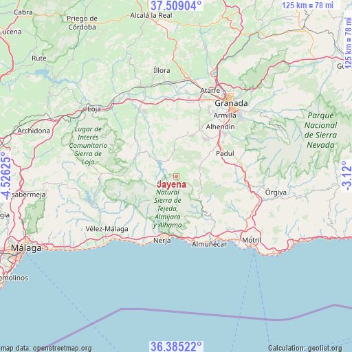
Jayena GPS coordinates[2]
36° 56' 57.12" North, 3° 49' 23.268" West
| Map corner | latitude | longitude |
|---|---|---|
| Upper-left | 37.50904°, | -4.52625° |
| Center: | 36.9492°, | -3.82313° |
| Lower-right: | 36.38522°, | -3.12° |
| Map W x H: | 125×125 km | = 77.7×77.7mi |
| max Lat: | 43.74134° ⇑95.7% North |
| Jayena: | 36.9492° |
| min Lat: | ⇓4.3% South 27.64134° |
| min Long | Jayena | max Long |
| -18.00367° | -3.82313° | 4.2899° |
| W 42.8%⇐ | ⇒57.2% E |
Elevation
Elevation of Jayena is 914 m = 2999 ft, and this is 316 m = 1037 ft above average elevation for this country.
| Max E: |
1682 m = 5518 ft | 18.2% |
| Jayena | 914 m 2999 ft | |
| Avg. | 598 m = 1962 ft | |
Min E: |
0 m = 0 ft | 81.8% |
See also: Spain elevation on elevation.city.
Geographical zone
Jayena is located in North temperate zone (between Tropic of Cancer and the Arctic Circle). Distance of this Northern Tropic circle is 1502.4 km =933.5 mi to South.| Distance of | km | miles | from Jayena |
|---|---|---|---|
| North Pole | 5898.7 | 3665.3 | to North |
| Arctic Circle | 3292.8 | 2046.1 | to North |
| Tropic Cancer | 1502.4 | 933.5 | to South |
| Equator | 4108.4 | 2552.8 | to South |


Nearby cities:
15 places around Jayena: (largest is in red/bold)
• Agrón
9 km =5.6 mi,  356°
356°
• Albuñuelas
17.2 km =10.7 mi,  97°
97°
• Alhama de Granada
16.1 km =10 mi,  293°
293°
• Arenas del Rey
6.3 km =3.9 mi,  278°
278°
• Canillas de Albaida
18.5 km =11.5 mi,  231°
231°
• Chimeneas
20.2 km =12.6 mi,  0°
0°
• Cómpeta
18.6 km =11.6 mi, 226°
• Escúzar
13.7 km =8.5 mi,  23°
23°
• Frigiliana
19.1 km =11.9 mi,  199°
199°
• Lentegí
18.3 km =11.4 mi,  133°
133°
• Otívar
19.6 km =12.2 mi,  139°
139°
• Padul
19.4 km =12.1 mi,  64°
64°
• Salares
20.8 km =12.9 mi,  239°
239°
• Ventas de Huelma
13.3 km =8.3 mi, 1°
• Árchez
19.3 km =12 mi, 231°
Sources, notices
• [Note1] Compared only with cities in Spain existing in our database
• [Src1] Map data: © OpenStreetMap contributors (CC-BY-SA)
• [Src2] Other city data from geonames.org with taken over terms of usage.
• [Src3] Geographical zone / Annual Mean Temperature by Robert A. Rohde @ Wikipedia
