Ventas de Huelma geodata
Ventas de Huelma (Andalusia) is a seat of a third-order administrative division; located in Spain in Europe/Madrid (GMT+2) time zone. With population of 659 people, there are 3487 cities with bigger population in this country. Compared to other cities in Spain, 94.9% of cities are located further ↑North; 57.1% of cities are located further →East and 75.7% of cities have lower elevation than Ventas de Huelma. Note1
Administrative division(s):
- Level 1: Andalusia
- Level 2: Provincia de Granada
- Level 3: Ventas de Huelma


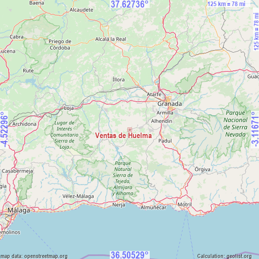
Ventas de Huelma GPS coordinates[2]
37° 4' 6.24" North, 3° 49' 11.388" West
| Map corner | latitude | longitude |
|---|---|---|
| Upper-left | 37.62736°, | -4.52296° |
| Center: | 37.0684°, | -3.81983° |
| Lower-right: | 36.50529°, | -3.11671° |
| Map W x H: | 124.8×124.8 km | = 77.5×77.5mi |
| max Lat: | 43.74134° ⇑94.9% North |
| Ventas de Huelma: | 37.0684° |
| min Lat: | ⇓5.1% South 27.64134° |
| min Long | Ventas de Huelm | max Long |
| -18.00367° | -3.81983° | 4.2899° |
| W 42.9%⇐ | ⇒57.1% E |
Elevation
Elevation of Ventas de Huelma is 858 m = 2815 ft, and this is 260 m = 853 ft above average elevation for this country.
| Max E: |
1682 m = 5518 ft | 24.3% |
| Ventas de Huelma | 858 m 2815 ft | |
| Avg. | 598 m = 1962 ft | |
Min E: |
0 m = 0 ft | 75.7% |
See also: Spain elevation on elevation.city.
Geographical zone
Ventas de Huelma is located in North temperate zone (between Tropic of Cancer and the Arctic Circle). Distance of this Northern Tropic circle is 1515.7 km =941.8 mi to South.| Distance of | km | miles | from Ventas de Huelma |
|---|---|---|---|
| North Pole | 5885.4 | 3657 | to North |
| Arctic Circle | 3279.6 | 2037.8 | to North |
| Tropic Cancer | 1515.7 | 941.8 | to South |
| Equator | 4121.6 | 2561 | to South |


Nearby cities:
15 places around Ventas de Huelma: (largest is in red/bold)
• Agrón
4.3 km =2.7 mi,  190°
190°
• Alhama de Granada
16.6 km =10.3 mi,  245°
245°
• Alhendín
16.1 km =10 mi,  73°
73°
• Arenas del Rey
13.9 km =8.6 mi,  208°
208°
• Chauchina
15.2 km =9.4 mi,  16°
16°
• Chimeneas
7 km =4.3 mi,  358°
358°
• Cijuela
14.4 km =8.9 mi,  2°
2°
• Cúllar-Vega
16.3 km =10.1 mi,  54°
54°
• Escúzar
5.2 km =3.2 mi,  97°
97°
• Jayena
13.3 km =8.3 mi,  181°
181°
• Las Gabias
15.2 km =9.4 mi,  60°
60°
• Láchar
14.1 km =8.8 mi, 355°
• Moraleda de Zafayona
16.9 km =10.5 mi,  310°
310°
• Otura
16.7 km =10.4 mi,  82°
82°
• Santafé
16.1 km =10 mi,  33°
33°
Sources, notices
• [Note1] Compared only with cities in Spain existing in our database
• [Src1] Map data: © OpenStreetMap contributors (CC-BY-SA)
• [Src2] Other city data from geonames.org with taken over terms of usage.
• [Src3] Geographical zone / Annual Mean Temperature by Robert A. Rohde @ Wikipedia
