Fuente del Maestre geodata
Fuente del Maestre (Extremadura) is a seat of a third-order administrative division; located in Spain in Europe/Madrid (GMT+2) time zone. With population of 6,748 people, there are 1063 cities with bigger population in this country. Compared to other cities in Spain, 85.5% of cities are located further ↑North; 90.8% of cities are located further →East and 66.2% of cities have higher elevation than Fuente del Maestre. Note1
Administrative division(s):
- Level 1: Extremadura
- Level 2: Provincia de Badajoz
- Level 3: Fuente del Maestre


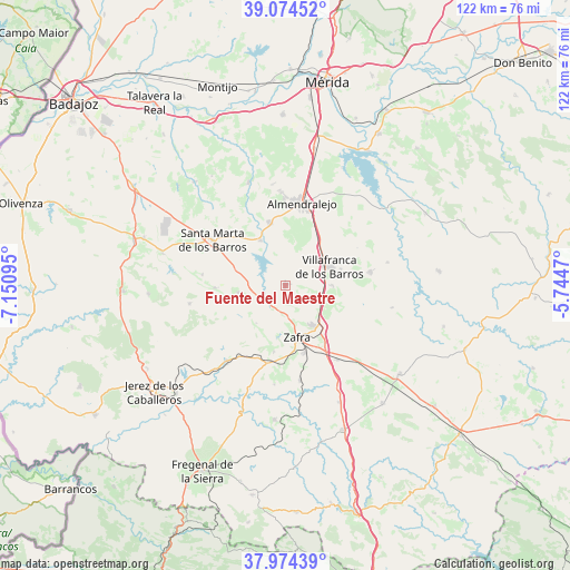
Fuente del Maestre GPS coordinates[2]
38° 31' 35.616" North, 6° 26' 52.152" West
| Map corner | latitude | longitude |
|---|---|---|
| Upper-left | 39.07452°, | -7.15095° |
| Center: | 38.52656°, | -6.44782° |
| Lower-right: | 37.97439°, | -5.7447° |
| Map W x H: | 122.3×122.3 km | = 76×76mi |
| max Lat: | 43.74134° ⇑85.5% North |
| Fuente del Maestre: | 38.52656° |
| min Lat: | ⇓14.5% South 27.64134° |
| min Long | Fuente del Maes | max Long |
| -18.00367° | -6.44782° | 4.2899° |
| W 9.2%⇐ | ⇒90.8% E |
Elevation
Elevation of Fuente del Maestre is 444 m = 1457 ft, and this is 154 m = 505 ft below average elevation for this country.
| Max E: |
1682 m = 5518 ft | 66.2% |
| Avg. | 598 m = 1962 ft | |
| Fuente del Maestre | 444 m = 1457 ft | |
Min E: |
0 m = 0 ft | 33.8% |
See also: Spain elevation on elevation.city.
Geographical zone
Fuente del Maestre is located in North temperate zone (between Tropic of Cancer and the Arctic Circle). Distance of this Northern Tropic circle is 1677.8 km =1042.5 mi to South.| Distance of | km | miles | from Fuente del Maestre |
|---|---|---|---|
| North Pole | 5723.3 | 3556.3 | to North |
| Arctic Circle | 3117.4 | 1937.1 | to North |
| Tropic Cancer | 1677.8 | 1042.5 | to South |
| Equator | 4283.8 | 2661.8 | to South |


Nearby cities:
15 places around Fuente del Maestre: (largest is in red/bold)
• Aceuchal
13.7 km =8.5 mi,  345°
345°
• Alconera
14.2 km =8.8 mi,  186°
186°
• Almendralejo
17.8 km =11.1 mi,  11°
11°
• Burguillos del Cerro
20.5 km =12.7 mi,  217°
217°
• Feria
10.3 km =6.4 mi,  260°
260°
• La Morera
18 km =11.2 mi,  276°
276°
• La Parra
15.2 km =9.4 mi,  267°
267°
• Los Santos de Maimona
10.2 km =6.3 mi,  146°
146°
• Puebla de Sancho Pérez
14.7 km =9.1 mi,  163°
163°
• Ribera del Fresno
18.5 km =11.5 mi,  81°
81°
• Salvatierra de los Barros
20.9 km =13 mi, 259°
• Santa Marta
18.4 km =11.4 mi,  301°
301°
• Villafranca de los Barros
10.3 km =6.4 mi,  67°
67°
• Villalba de los Barros
11 km =6.8 mi,  330°
330°
• Zafra
11.6 km =7.2 mi,  166°
166°
Sources, notices
• [Note1] Compared only with cities in Spain existing in our database
• [Src1] Map data: © OpenStreetMap contributors (CC-BY-SA)
• [Src2] Other city data from geonames.org with taken over terms of usage.
• [Src3] Geographical zone / Annual Mean Temperature by Robert A. Rohde @ Wikipedia
