Espelúy geodata
Espelúy (Andalusia) is a seat of a third-order administrative division; located in Spain in Europe/Madrid (GMT+2) time zone. With population of 771 people, there are 3267 cities with bigger population in this country. Compared to other cities in Spain, 88.3% of cities are located further ↑North; 57.7% of cities are located further →East and 76.4% of cities have higher elevation than Espelúy. Note1


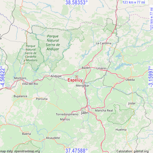
Espelúy GPS coordinates[2]
38° 1' 54.48" North, 3° 51' 47.124" West
| Map corner | latitude | longitude |
|---|---|---|
| Upper-left | 38.58353°, | -4.56622° |
| Center: | 38.0318°, | -3.86309° |
| Lower-right: | 37.47588°, | -3.15997° |
| Map W x H: | 123.2×123.2 km | = 76.6×76.6mi |
| max Lat: | 43.74134° ⇑88.3% North |
| Espelúy: | 38.0318° |
| min Lat: | ⇓11.7% South 27.64134° |
| min Long | Espelúy | max Long |
| -18.00367° | -3.86309° | 4.2899° |
| W 42.3%⇐ | ⇒57.7% E |
Elevation
Elevation of Espelúy is 280 m = 919 ft, and this is 318 m = 1043 ft below average elevation for this country.
| Max E: |
1682 m = 5518 ft | 76.4% |
| Avg. | 598 m = 1962 ft | |
| Espelúy | 280 m = 919 ft | |
Min E: |
0 m = 0 ft | 23.6% |
See also: Spain elevation on elevation.city.
Geographical zone
Espelúy is located in North temperate zone (between Tropic of Cancer and the Arctic Circle). Distance of this Northern Tropic circle is 1622.8 km =1008.4 mi to South.| Distance of | km | miles | from Espelúy |
|---|---|---|---|
| North Pole | 5778.3 | 3590.5 | to North |
| Arctic Circle | 3172.4 | 1971.2 | to North |
| Tropic Cancer | 1622.8 | 1008.4 | to South |
| Equator | 4228.7 | 2627.6 | to South |


Nearby cities:
15 places around Espelúy: (largest is in red/bold)
• Andújar
16.5 km =10.3 mi,  272°
272°
• Arjona
20 km =12.4 mi,  237°
237°
• Arjonilla
22.3 km =13.9 mi,  253°
253°
• Bailén
10.4 km =6.5 mi,  46°
46°
• Baños de la Encina
17.6 km =10.9 mi,  26°
26°
• Cazalilla
5.6 km =3.5 mi,  198°
198°
• Escañuela
22.7 km =14.1 mi,  221°
221°
• Fuerte del Rey
17.5 km =10.9 mi,  185°
185°
• Guarromán
22.8 km =14.2 mi,  42°
42°
• Higuera de Arjona
13.1 km =8.1 mi, 238°
• Jabalquinto
12.2 km =7.6 mi,  96°
96°
• Linares
21.1 km =13.1 mi,  70°
70°
• Mengibar
8.4 km =5.2 mi,  145°
145°
• Torreblascopedro
20.1 km =12.5 mi, 100°
• Villanueva de la Reina
5.6 km =3.5 mi, 236°
Sources, notices
• [Note1] Compared only with cities in Spain existing in our database
• [Src1] Map data: © OpenStreetMap contributors (CC-BY-SA)
• [Src2] Other city data from geonames.org with taken over terms of usage.
• [Src3] Geographical zone / Annual Mean Temperature by Robert A. Rohde @ Wikipedia
