Linares geodata
Linares (Andalusia) is a seat of a third-order administrative division; located in Spain in Europe/Madrid (GMT+2) time zone. With population of 61,338 people, there are 154 cities with bigger population in this country. Compared to other cities in Spain, 87.8% of cities are located further ↑North; 54.3% of cities are located further →East and 68.2% of cities have higher elevation than Linares. Note1


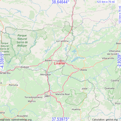
Linares GPS coordinates[2]
38° 5' 42.684" North, 3° 38' 9.672" West
| Map corner | latitude | longitude |
|---|---|---|
| Upper-left | 38.64644°, | -4.33915° |
| Center: | 38.09519°, | -3.63602° |
| Lower-right: | 37.53975°, | -2.9329° |
| Map W x H: | 123.1×123.1 km | = 76.5×76.5mi |
| max Lat: | 43.74134° ⇑87.8% North |
| Linares: | 38.09519° |
| min Lat: | ⇓12.2% South 27.64134° |
| min Long | Linares | max Long |
| -18.00367° | -3.63602° | 4.2899° |
| W 45.7%⇐ | ⇒54.3% E |
Elevation
Elevation of Linares is 413 m = 1355 ft, and this is 185 m = 607 ft below average elevation for this country.
| Max E: |
1682 m = 5518 ft | 68.2% |
| Avg. | 598 m = 1962 ft | |
| Linares | 413 m = 1355 ft | |
Min E: |
0 m = 0 ft | 31.8% |
See also: Linares elevation on elevation.city.
Geographical zone
Linares is located in North temperate zone (between Tropic of Cancer and the Arctic Circle). Distance of this Northern Tropic circle is 1629.9 km =1012.8 mi to South.| Distance of | km | miles | from Linares |
|---|---|---|---|
| North Pole | 5771.3 | 3586.1 | to North |
| Arctic Circle | 3165.4 | 1966.9 | to North |
| Tropic Cancer | 1629.9 | 1012.8 | to South |
| Equator | 4235.8 | 2632 | to South |


Nearby cities:
15 places around Linares: (largest is in red/bold)
• Arquillos
20.5 km =12.7 mi,  62°
62°
• Baeza
18.3 km =11.4 mi,  127°
127°
• Bailén
12.4 km =7.7 mi,  270°
270°
• Baños de la Encina
15 km =9.3 mi,  305°
305°
• Begíjar
15.3 km =9.5 mi,  143°
143°
• Canena
14.3 km =8.9 mi,  110°
110°
• Carboneros
14.9 km =9.3 mi,  1°
1°
• Guarromán
10.7 km =6.6 mi,  335°
335°
• Ibros
14.3 km =8.9 mi, 125°
• Jabalquinto
11.5 km =7.1 mi,  222°
222°
• La Carolina
20.1 km =12.5 mi,  5°
5°
• Lupión
13.5 km =8.4 mi, 144°
• Rus
16.1 km =10 mi, 109°
• Torreblascopedro
10.9 km =6.8 mi,  180°
180°
• Vilches
16.6 km =10.3 mi,  41°
41°
Sources, notices
• [Note1] Compared only with cities in Spain existing in our database
• [Src1] Map data: © OpenStreetMap contributors (CC-BY-SA)
• [Src2] Other city data from geonames.org with taken over terms of usage.
• [Src3] Geographical zone / Annual Mean Temperature by Robert A. Rohde @ Wikipedia
