Dos Aguas geodata
Dos Aguas (Valencia) is a seat of a third-order administrative division; located in Spain in Europe/Madrid (GMT+2) time zone. With population of 441 people, there are 4028 cities with bigger population in this country. Compared to other cities in Spain, 78.8% of cities are located further ↑North; 78.8% of cities are located further ←West and 75.4% of cities have higher elevation than Dos Aguas. Note1


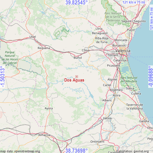
Dos Aguas GPS coordinates[2]
39° 16' 59.988" North, 0° 48' 0" West
| Map corner | latitude | longitude |
|---|---|---|
| Upper-left | 39.82545°, | -1.50313° |
| Center: | 39.28333°, | -0.8° |
| Lower-right: | 38.73698°, | -0.09688° |
| Map W x H: | 121×121 km | = 75.2×75.2mi |
| max Lat: | 43.74134° ⇑78.8% North |
| Dos Aguas: | 39.28333° |
| min Lat: | ⇓21.2% South 27.64134° |
| min Long | Dos Aguas | max Long |
| -18.00367° | -0.8° | 4.2899° |
| W 78.8%⇐ | ⇒21.2% E |
Elevation
Elevation of Dos Aguas is 293 m = 961 ft, and this is 305 m = 1001 ft below average elevation for this country.
| Max E: |
1682 m = 5518 ft | 75.4% |
| Avg. | 598 m = 1962 ft | |
| Dos Aguas | 293 m = 961 ft | |
Min E: |
0 m = 0 ft | 24.6% |
See also: Spain elevation on elevation.city.
Geographical zone
Dos Aguas is located in North temperate zone (between Tropic of Cancer and the Arctic Circle). Distance of this Northern Tropic circle is 1762 km =1094.9 mi to South.| Distance of | km | miles | from Dos Aguas |
|---|---|---|---|
| North Pole | 5639.2 | 3504 | to North |
| Arctic Circle | 3033.3 | 1884.8 | to North |
| Tropic Cancer | 1762 | 1094.9 | to South |
| Equator | 4367.9 | 2714.1 | to South |


Nearby cities:
15 places around Dos Aguas: (largest is in red/bold)
• Alborache
11.5 km =7.1 mi,  14°
14°
• Bicorp
16.8 km =10.4 mi,  176°
176°
• Buñol
14.9 km =9.3 mi, 5°
• Catadau
20.2 km =12.6 mi,  95°
95°
• Cortes de Pallás
12.1 km =7.5 mi,  252°
252°
• Godelleta
17.9 km =11.1 mi,  34°
34°
• Llombai
20.1 km =12.5 mi,  90°
90°
• Macastre
11.2 km =7 mi, 7°
• Millares
4.7 km =2.9 mi,  142°
142°
• Monserrat
19.5 km =12.1 mi,  61°
61°
• Montroy
16.7 km =10.4 mi,  70°
70°
• Quesa
18.9 km =11.7 mi,  164°
164°
• Real de Montroi
18.1 km =11.2 mi, 72°
• Turís
14.1 km =8.8 mi,  37°
37°
• Yátova
11.1 km =6.9 mi,  0°
0°
Sources, notices
• [Note1] Compared only with cities in Spain existing in our database
• [Src1] Map data: © OpenStreetMap contributors (CC-BY-SA)
• [Src2] Other city data from geonames.org with taken over terms of usage.
• [Src3] Geographical zone / Annual Mean Temperature by Robert A. Rohde @ Wikipedia
