Cortes de Pallás geodata
Cortes de Pallás (Valencia) is a seat of a third-order administrative division; located in Spain in Europe/Madrid (GMT+2) time zone. With population of 999 people, there are 2943 cities with bigger population in this country. Compared to other cities in Spain, 79% of cities are located further ↑North; 77.7% of cities are located further ←West and 71.5% of cities have higher elevation than Cortes de Pallás. Note1
Administrative division(s):
- Level 1: Valencia
- Level 2: Província de València
- Level 3: Cortes de Pallás


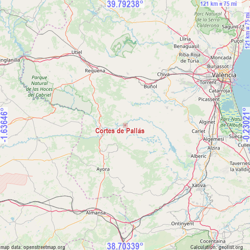
Cortes de Pallás GPS coordinates[2]
39° 15' 0" North, 0° 55' 59.988" West
| Map corner | latitude | longitude |
|---|---|---|
| Upper-left | 39.79238°, | -1.63646° |
| Center: | 39.25°, | -0.93333° |
| Lower-right: | 38.70339°, | -0.23021° |
| Map W x H: | 121.1×121.1 km | = 75.2×75.2mi |
| max Lat: | 43.74134° ⇑79% North |
| Cortes de Pallás: | 39.25° |
| min Lat: | ⇓21% South 27.64134° |
| min Long | Cortes de Pall� | max Long |
| -18.00367° | -0.93333° | 4.2899° |
| W 77.7%⇐ | ⇒22.3% E |
Elevation
Elevation of Cortes de Pallás is 356 m = 1168 ft, and this is 242 m = 794 ft below average elevation for this country.
| Max E: |
1682 m = 5518 ft | 71.5% |
| Avg. | 598 m = 1962 ft | |
| Cortes de Pallás | 356 m = 1168 ft | |
Min E: |
0 m = 0 ft | 28.5% |
See also: Spain elevation on elevation.city.
Geographical zone
Cortes de Pallás is located in North temperate zone (between Tropic of Cancer and the Arctic Circle). Distance of this Northern Tropic circle is 1758.3 km =1092.6 mi to South.| Distance of | km | miles | from Cortes de Pallás |
|---|---|---|---|
| North Pole | 5642.9 | 3506.3 | to North |
| Arctic Circle | 3037 | 1887.1 | to North |
| Tropic Cancer | 1758.3 | 1092.6 | to South |
| Equator | 4364.2 | 2711.8 | to South |


Nearby cities:
15 places around Cortes de Pallás: (largest is in red/bold)
• Alborache
20.6 km =12.8 mi,  44°
44°
• Ayora
23.8 km =14.8 mi,  206°
206°
• Balsa de Ves
23 km =14.3 mi,  274°
274°
• Bicorp
18.2 km =11.3 mi,  136°
136°
• Buñol
22.6 km =14 mi,  34°
34°
• Cofrentes
11.2 km =7 mi,  258°
258°
• Dos Aguas
12.1 km =7.5 mi,  72°
72°
• Jalance
12.8 km =8 mi,  244°
244°
• Jarafuel
17.2 km =10.7 mi,  224°
224°
• Macastre
19.7 km =12.2 mi, 41°
• Millares
14.4 km =8.9 mi,  90°
90°
• Quesa
22.1 km =13.7 mi,  131°
131°
• Teresa de Cofrentes
19 km =11.8 mi, 212°
• Yátova
18.7 km =11.6 mi, 37°
• Zarra
21.4 km =13.3 mi, 214°
Sources, notices
• [Note1] Compared only with cities in Spain existing in our database
• [Src1] Map data: © OpenStreetMap contributors (CC-BY-SA)
• [Src2] Other city data from geonames.org with taken over terms of usage.
• [Src3] Geographical zone / Annual Mean Temperature by Robert A. Rohde @ Wikipedia
