Cabeza del Buey geodata
Cabeza del Buey (Extremadura) is a seat of a third-order administrative division; located in Spain in Europe/Madrid (GMT+2) time zone. With population of 5,590 people, there are 1196 cities with bigger population in this country. Compared to other cities in Spain, 84% of cities are located further ↑North; 75.4% of cities are located further →East and 59.8% of cities have higher elevation than Cabeza del Buey. Note1
Administrative division(s):
- Level 1: Extremadura
- Level 2: Provincia de Badajoz
- Level 3: Cabeza del Buey


Cabeza del Buey GPS coordinates[2]
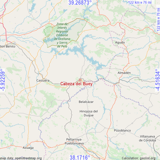
38° 43' 20.172" North, 5° 13' 10.056" West
| Map corner | latitude | longitude |
|---|---|---|
| Upper-left | 39.26873°, | -5.92259° |
| Center: | 38.72227°, | -5.21946° |
| Lower-right: | 38.1716°, | -4.51634° |
| Map W x H: | 122×122 km | = 75.8×75.8mi |
| max Lat: | 43.74134° ⇑84% North |
| Cabeza del Buey: | 38.72227° |
| min Lat: | ⇓16% South 27.64134° |
| min Long | Cabeza del Buey | max Long |
| -18.00367° | -5.21946° | 4.2899° |
| W 24.6%⇐ | ⇒75.4% E |
Elevation
Elevation of Cabeza del Buey is 531 m = 1742 ft, and this is 67 m = 220 ft below average elevation for this country.
| Max E: |
1682 m = 5518 ft | 59.8% |
| Avg. | 598 m = 1962 ft | |
| Cabeza del Buey | 531 m = 1742 ft | |
Min E: |
0 m = 0 ft | 40.2% |
See also: Spain elevation on elevation.city.
Geographical zone
Cabeza del Buey is located in North temperate zone (between Tropic of Cancer and the Arctic Circle). Distance of this Northern Tropic circle is 1699.6 km =1056.1 mi to South.| Distance of | km | miles | from Cabeza del Buey |
|---|---|---|---|
| North Pole | 5701.5 | 3542.7 | to North |
| Arctic Circle | 3095.7 | 1923.6 | to North |
| Tropic Cancer | 1699.6 | 1056.1 | to South |
| Equator | 4305.5 | 2675.3 | to South |


Nearby cities:
15 places around Cabeza del Buey: (largest is in red/bold)
• Almadén
34.2 km =21.3 mi,  80°
80°
• Belalcázar
16.9 km =10.5 mi,  164°
164°
• Benquerencia de la Serena
24 km =14.9 mi,  264°
264°
• Capilla
16 km =9.9 mi,  47°
47°
• Castuera
28.2 km =17.5 mi,  272°
272°
• Chillón
31.7 km =19.7 mi, 75°
• Esparragosa de Lares
28.5 km =17.7 mi,  351°
351°
• Garlitos
23 km =14.3 mi,  40°
40°
• Guadalmez
21.6 km =13.4 mi,  88°
88°
• Hinojosa del Duque
25.5 km =15.8 mi,  165°
165°
• Monterrubio de la Serena
24.6 km =15.3 mi,  232°
232°
• Peñalsordo
14.2 km =8.8 mi, 40°
• Puebla de Alcocer
29.6 km =18.4 mi, 353°
• Santa Eufemia
30.9 km =19.2 mi,  116°
116°
• Siruela
31.9 km =19.8 mi,  27°
27°
Sources, notices
• [Note1] Compared only with cities in Spain existing in our database
• [Src1] Map data: © OpenStreetMap contributors (CC-BY-SA)
• [Src2] Other city data from geonames.org with taken over terms of usage.
• [Src3] Geographical zone / Annual Mean Temperature by Robert A. Rohde @ Wikipedia
