Fuente el Fresno geodata
Fuente el Fresno (Castille-La Mancha) is a populated place; located in Spain in Europe/Madrid (GMT+2) time zone. With population of 3,454 people, there are 1596 cities with bigger population in this country. Compared to other cities in Spain, 79.2% of cities are located further ↑North; 56.4% of cities are located further →East and 52.3% of cities have lower elevation than Fuente el Fresno. Note1
Administrative division(s):
- Level 1: Castille-La Mancha
- Level 2: Provincia de Ciudad Real
- Level 3: Villarrubia de los Ojos


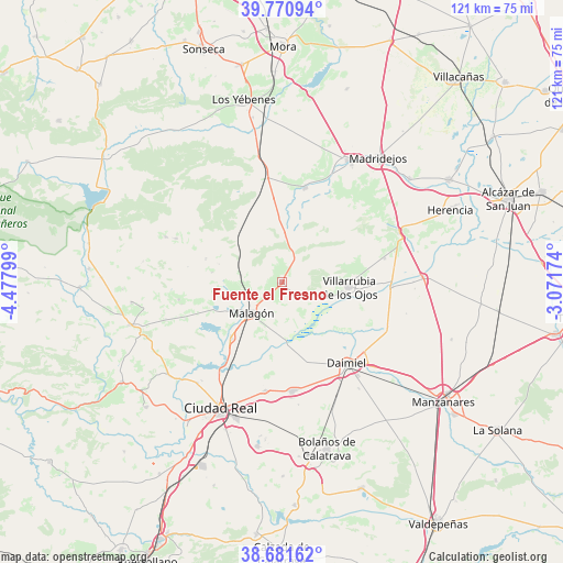
Fuente el Fresno GPS coordinates[2]
39° 13' 42.204" North, 3° 46' 29.532" West
| Map corner | latitude | longitude |
|---|---|---|
| Upper-left | 39.77094°, | -4.47799° |
| Center: | 39.22839°, | -3.77487° |
| Lower-right: | 38.68162°, | -3.07174° |
| Map W x H: | 121.1×121.1 km | = 75.2×75.2mi |
| max Lat: | 43.74134° ⇑79.2% North |
| Fuente el Fresno: | 39.22839° |
| min Lat: | ⇓20.8% South 27.64134° |
| min Long | Fuente el Fresn | max Long |
| -18.00367° | -3.77487° | 4.2899° |
| W 43.6%⇐ | ⇒56.4% E |
Elevation
Elevation of Fuente el Fresno is 682 m = 2238 ft, and this is 84 m = 276 ft above average elevation for this country.
| Max E: |
1682 m = 5518 ft | 47.7% |
| Fuente el Fresno | 682 m 2238 ft | |
| Avg. | 598 m = 1962 ft | |
Min E: |
0 m = 0 ft | 52.3% |
See also: Spain elevation on elevation.city.
Geographical zone
Fuente el Fresno is located in North temperate zone (between Tropic of Cancer and the Arctic Circle). Distance of this Northern Tropic circle is 1755.9 km =1091.1 mi to South.| Distance of | km | miles | from Fuente el Fresno |
|---|---|---|---|
| North Pole | 5645.3 | 3507.8 | to North |
| Arctic Circle | 3039.4 | 1888.6 | to North |
| Tropic Cancer | 1755.9 | 1091.1 | to South |
| Equator | 4361.8 | 2710.3 | to South |


Nearby cities:
15 places around Fuente el Fresno: (largest is in red/bold)
• Arenas de San Juan
23.5 km =14.6 mi,  92°
92°
• Ballesteros
17.2 km =10.7 mi,  287°
287°
• Carrión de Calatrava
23.6 km =14.7 mi,  188°
188°
• Ciudad Real
30 km =18.6 mi,  206°
206°
• Consuegra
29.7 km =18.5 mi,  28°
28°
• Daimiel
22.4 km =13.9 mi,  141°
141°
• Fuencaliente
22.1 km =13.7 mi,  257°
257°
• Las Labores
22.6 km =14 mi,  76°
76°
• Malagón
9.7 km =6 mi,  224°
224°
• Miguelturra
31 km =19.3 mi,  198°
198°
• Puerto Lápice
27.4 km =17 mi,  67°
67°
• Torralba de Calatrava
23.5 km =14.6 mi,  174°
174°
• Urda
21 km =13 mi,  14°
14°
• Villarrubia de los Ojos
14.4 km =8.9 mi, 93°
• Villarta de San Juan
30.3 km =18.8 mi, 88°
Sources, notices
• [Note1] Compared only with cities in Spain existing in our database
• [Src1] Map data: © OpenStreetMap contributors (CC-BY-SA)
• [Src2] Other city data from geonames.org with taken over terms of usage.
• [Src3] Geographical zone / Annual Mean Temperature by Robert A. Rohde @ Wikipedia
