Zarzalejo geodata
Zarzalejo (Madrid) is a seat of a third-order administrative division; located in Spain in Europe/Madrid (GMT+2) time zone. With population of 1,327 people, there are 2618 cities with bigger population in this country. Compared to other cities in Spain, 60.9% of cities are located further ↑North; 62.3% of cities are located further →East and 93.7% of cities have lower elevation than Zarzalejo. Note1


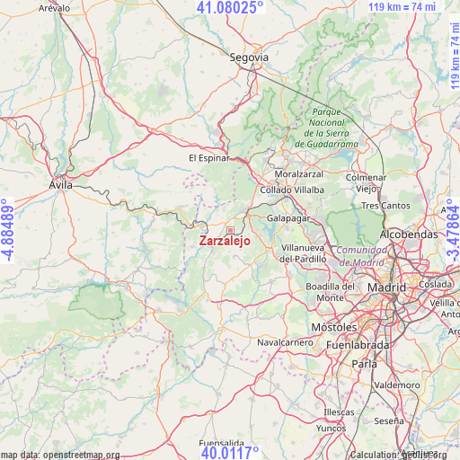
Zarzalejo GPS coordinates[2]
40° 32' 53.196" North, 4° 10' 54.336" West
| Map corner | latitude | longitude |
|---|---|---|
| Upper-left | 41.08025°, | -4.88489° |
| Center: | 40.54811°, | -4.18176° |
| Lower-right: | 40.0117°, | -3.47864° |
| Map W x H: | 118.8×118.8 km | = 73.8×73.8mi |
| max Lat: | 43.74134° ⇑60.9% North |
| Zarzalejo: | 40.54811° |
| min Lat: | ⇓39.1% South 27.64134° |
| min Long | Zarzalejo | max Long |
| -18.00367° | -4.18176° | 4.2899° |
| W 37.7%⇐ | ⇒62.3% E |
Elevation
Elevation of Zarzalejo is 1110 m = 3642 ft, and this is 512 m = 1680 ft above average elevation for this country.
| Max E: |
1682 m = 5518 ft | 6.3% |
| Zarzalejo | 1110 m 3642 ft | |
| Avg. | 598 m = 1962 ft | |
Min E: |
0 m = 0 ft | 93.7% |
See also: Spain elevation on elevation.city.
Geographical zone
Zarzalejo is located in North temperate zone (between Tropic of Cancer and the Arctic Circle). Distance of this Northern Tropic circle is 1902.6 km =1182.2 mi to South.| Distance of | km | miles | from Zarzalejo |
|---|---|---|---|
| North Pole | 5498.5 | 3416.6 | to North |
| Arctic Circle | 2892.6 | 1797.4 | to North |
| Tropic Cancer | 1902.6 | 1182.2 | to South |
| Equator | 4508.5 | 2801.5 | to South |


Nearby cities:
15 places around Zarzalejo: (largest is in red/bold)
• Colmenar del Arroyo
14.4 km =8.9 mi,  185°
185°
• Colmenarejo
14 km =8.7 mi,  84°
84°
• El Escorial
5.9 km =3.7 mi,  49°
49°
• Fresnedillas
6.8 km =4.2 mi,  172°
172°
• Galapagar
15.4 km =9.6 mi, 77°
• Guadarrama
15.9 km =9.9 mi,  29°
29°
• Las Navas del Marqués
14.2 km =8.8 mi,  295°
295°
• Navalagamella
10.1 km =6.3 mi,  150°
150°
• Navalquejigo
12.9 km =8 mi,  59°
59°
• Peguerinos
9.6 km =6 mi,  334°
334°
• Robledo de Chavela
7 km =4.3 mi,  221°
221°
• San Lorenzo de El Escorial
5.6 km =3.5 mi, 31°
• Santa María de la Alameda
8.3 km =5.2 mi,  309°
309°
• Valdemaqueda
10.6 km =6.6 mi,  247°
247°
• Valdemorillo
11 km =6.8 mi,  118°
118°
Sources, notices
• [Note1] Compared only with cities in Spain existing in our database
• [Src1] Map data: © OpenStreetMap contributors (CC-BY-SA)
• [Src2] Other city data from geonames.org with taken over terms of usage.
• [Src3] Geographical zone / Annual Mean Temperature by Robert A. Rohde @ Wikipedia
