Villavieja del Lozoya geodata
Villavieja del Lozoya (Madrid) is a seat of a third-order administrative division; located in Spain in Europe/Madrid (GMT+2) time zone. With population of 197 people, there are 5052 cities with bigger population in this country. Compared to other cities in Spain, 51.5% of cities are located further ↑North; 54.8% of cities are located further →East and 90.5% of cities have lower elevation than Villavieja del Lozoya. Note1
Administrative division(s):
- Level 1: Madrid
- Level 2: Provincia de Madrid
- Level 3: Villavieja del Lozoya
Current local time in Villavieja del Lozoya:
11:57 PM, ThursdayDifference from your time zone: hours


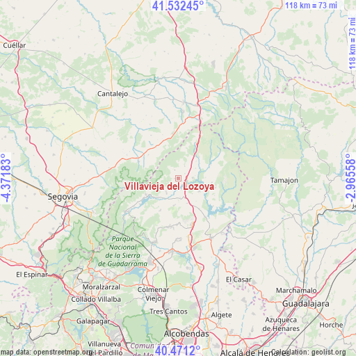
Villavieja del Lozoya GPS coordinates[2]
41° 0' 14.256" North, 3° 40' 7.32" West
| Map corner | latitude | longitude |
|---|---|---|
| Upper-left | 41.53245°, | -4.37183° |
| Center: | 41.00396°, | -3.6687° |
| Lower-right: | 40.4712°, | -2.96558° |
| Map W x H: | 118×118 km | = 73.3×73.3mi |
| max Lat: | 43.74134° ⇑51.5% North |
| Villavieja del Lozoya: | 41.00396° |
| min Lat: | ⇓48.5% South 27.64134° |
| min Long | Villavieja del | max Long |
| -18.00367° | -3.6687° | 4.2899° |
| W 45.2%⇐ | ⇒54.8% E |
Elevation
Elevation of Villavieja del Lozoya is 1040 m = 3412 ft, and this is 442 m = 1450 ft above average elevation for this country.
| Max E: |
1682 m = 5518 ft | 9.5% |
| Villavieja del Lozoya | 1040 m 3412 ft | |
| Avg. | 598 m = 1962 ft | |
Min E: |
0 m = 0 ft | 90.5% |
See also: Spain elevation on elevation.city.
Geographical zone
Villavieja del Lozoya is located in North temperate zone (between Tropic of Cancer and the Arctic Circle). Distance of this Northern Tropic circle is 1953.3 km =1213.7 mi to South.| Distance of | km | miles | from Villavieja del Lozoya |
|---|---|---|---|
| North Pole | 5447.8 | 3385.1 | to North |
| Arctic Circle | 2842 | 1765.9 | to North |
| Tropic Cancer | 1953.3 | 1213.7 | to South |
| Equator | 4559.2 | 2833 | to South |


Nearby cities:
15 places around Villavieja del Lozoya: (largest is in red/bold)
• Arcones
13.5 km =8.4 mi,  339°
339°
• Berzosa del Lozoya
12.9 km =8 mi,  105°
105°
• Braojos
4.6 km =2.9 mi,  27°
27°
• Buitrago del Lozoya
3.3 km =2.1 mi,  116°
116°
• Canencia
12.1 km =7.5 mi,  207°
207°
• Gallegos
12.6 km =7.8 mi,  308°
308°
• Garganta de los Montes
9.4 km =5.8 mi,  187°
187°
• Gascones
2.7 km =1.7 mi,  54°
54°
• Horcajo de la Sierra
9.9 km =6.2 mi,  44°
44°
• Horcajuelo de la Sierra
12 km =7.5 mi,  58°
58°
• Lozoya
11.9 km =7.4 mi,  239°
239°
• Matabuena
12.7 km =7.9 mi,  323°
323°
• Montejo de la Sierra
13.2 km =8.2 mi, 62°
• Prádena del Rincón
11.6 km =7.2 mi,  67°
67°
• Robregordo
13 km =8.1 mi, 28°
Sources, notices
• [Note1] Compared only with cities in Spain existing in our database
• [Src1] Map data: © OpenStreetMap contributors (CC-BY-SA)
• [Src2] Other city data from geonames.org with taken over terms of usage.
• [Src3] Geographical zone / Annual Mean Temperature by Robert A. Rohde @ Wikipedia
