Vilanova i la Geltrú geodata
Vilanova i la Geltrú (Catalonia) is a populated place; located in Spain in Europe/Madrid (GMT+2) time zone. With population of 65,890 people, there are 139 cities with bigger population in this country. Compared to other cities in Spain, 53.8% of cities are located further ↓South; 92.4% of cities are located further ←West and 94.9% of cities have higher elevation than Vilanova i la Geltrú. Note1
Administrative division(s):
- Level 1: Catalonia
- Level 2: Província de Barcelona
- Level 3: Vilanova i la Geltrú


Vilanova i la Geltrú GPS coordinates[2]
41° 13' 26.112" North, 1° 43' 30.396" East
| Map corner | latitude | longitude |
|---|---|---|
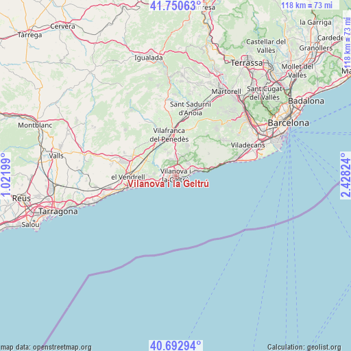
| Upper-left | 41.75063°, | 1.02199° |
| Center: | 41.22392°, | 1.72511° |
| Lower-right: | 40.69294°, | 2.42824° |
| Map W x H: | 117.6×117.6 km | = 73.1×73.1mi |
| max Lat: | 43.74134° ⇑46.2% North |
| Vilanova i la Geltrú: | 41.22392° |
| min Lat: | ⇓53.8% South 27.64134° |
| min Long | Vilanova i la G | max Long |
| -18.00367° | 1.72511° | 4.2899° |
| W 92.4%⇐ | ⇒7.6% E |
Elevation
Elevation of Vilanova i la Geltrú is 25 m = 82 ft, and this is 573 m = 1880 ft below average elevation for this country.
| Max E: |
1682 m = 5518 ft | 94.9% |
| Avg. | 598 m = 1962 ft | |
| Vilanova i la Geltrú | 25 m = 82 ft | |
Min E: |
0 m = 0 ft | 5.1% |
See also: Vilanova i la Geltrú elevation on elevation.city.
Geographical zone
Vilanova i la Geltrú is located in North temperate zone (between Tropic of Cancer and the Arctic Circle). Distance of this Northern Tropic circle is 1977.8 km =1228.9 mi to South.| Distance of | km | miles | from Vilanova i la Geltrú |
|---|---|---|---|
| North Pole | 5423.4 | 3369.9 | to North |
| Arctic Circle | 2817.5 | 1750.7 | to North |
| Tropic Cancer | 1977.8 | 1228.9 | to South |
| Equator | 4583.7 | 2848.2 | to South |


Nearby cities:
15 places around Vilanova i la Geltrú: (largest is in red/bold)
• Avinyonet del Penedès
14.8 km =9.2 mi,  19°
19°
• Calafell
13.4 km =8.3 mi,  258°
258°
• Castellet
8.8 km =5.5 mi,  299°
299°
• Coma-ruga
17.4 km =10.8 mi,  253°
253°
• Cubelles
4.7 km =2.9 mi, 247°
• Cunit
7.9 km =4.9 mi, 248°
• El Vendrell
16.1 km =10 mi,  267°
267°
• La Granada
17.2 km =10.7 mi,  358°
358°
• Olivella
12.8 km =8 mi,  36°
36°
• Sant Jaume dels Domenys
15.7 km =9.8 mi, 302°
• Sant Pere Molanta
13.9 km =8.6 mi,  5°
5°
• Sant Pere de Ribes
5.8 km =3.6 mi,  45°
45°
• Santa Oliva
14.9 km =9.3 mi,  282°
282°
• Sitges
7.4 km =4.6 mi,  80°
80°
• Vilafranca del Penedès
13.8 km =8.6 mi,  350°
350°
Sources, notices
• [Note1] Compared only with cities in Spain existing in our database
• [Src1] Map data: © OpenStreetMap contributors (CC-BY-SA)
• [Src2] Other city data from geonames.org with taken over terms of usage.
• [Src3] Geographical zone / Annual Mean Temperature by Robert A. Rohde @ Wikipedia
