Cunit geodata
Cunit (Catalonia) is a seat of a third-order administrative division; located in Spain in Europe/Madrid (GMT+2) time zone. With population of 12,279 people, there are 737 cities with bigger population in this country. Compared to other cities in Spain, 53.1% of cities are located further ↓South; 92.1% of cities are located further ←West and 97.9% of cities have higher elevation than Cunit. Note1


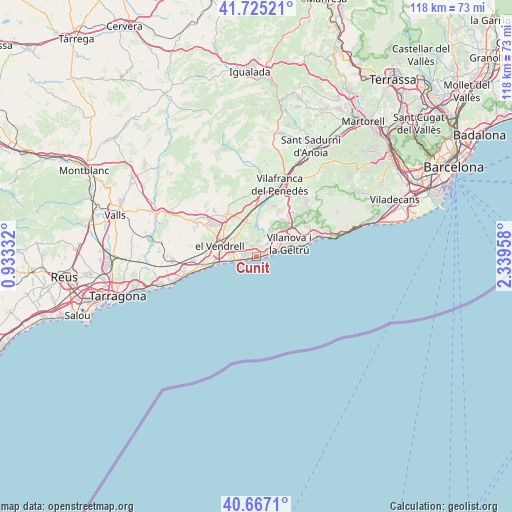
Cunit GPS coordinates[2]
41° 11' 53.844" North, 1° 38' 11.22" East
| Map corner | latitude | longitude |
|---|---|---|
| Upper-left | 41.72521°, | 0.93332° |
| Center: | 41.19829°, | 1.63645° |
| Lower-right: | 40.6671°, | 2.33958° |
| Map W x H: | 117.7×117.7 km | = 73.1×73.1mi |
| max Lat: | 43.74134° ⇑46.9% North |
| Cunit: | 41.19829° |
| min Lat: | ⇓53.1% South 27.64134° |
| min Long | Cunit | max Long |
| -18.00367° | 1.63645° | 4.2899° |
| W 92.1%⇐ | ⇒7.9% E |
Elevation
Elevation of Cunit is 12 m = 39 ft, and this is 586 m = 1923 ft below average elevation for this country.
| Max E: |
1682 m = 5518 ft | 97.9% |
| Avg. | 598 m = 1962 ft | |
| Cunit | 12 m = 39 ft | |
Min E: |
0 m = 0 ft | 2.1% |
See also: Spain elevation on elevation.city.
Geographical zone
Cunit is located in North temperate zone (between Tropic of Cancer and the Arctic Circle). Distance of this Northern Tropic circle is 1974.9 km =1227.1 mi to South.| Distance of | km | miles | from Cunit |
|---|---|---|---|
| North Pole | 5426.2 | 3371.7 | to North |
| Arctic Circle | 2820.4 | 1752.5 | to North |
| Tropic Cancer | 1974.9 | 1227.1 | to South |
| Equator | 4580.8 | 2846.4 | to South |


Nearby cities:
15 places around Cunit: (largest is in red/bold)
• Albinyana
14 km =8.7 mi,  294°
294°
• Bonastre
16.7 km =10.4 mi,  278°
278°
• Calafell
5.7 km =3.5 mi,  271°
271°
• Castellet
7.2 km =4.5 mi,  358°
358°
• Coma-ruga
9.5 km =5.9 mi,  257°
257°
• Creixell
16.8 km =10.4 mi, 257°
• Cubelles
3.2 km =2 mi,  70°
70°
• El Vendrell
8.9 km =5.5 mi, 283°
• Roda de Barà
14.9 km =9.3 mi, 264°
• Sant Jaume dels Domenys
12.7 km =7.9 mi,  332°
332°
• Sant Pere de Ribes
13.4 km =8.3 mi,  58°
58°
• Santa Oliva
9.4 km =5.8 mi,  310°
310°
• Sitges
15.2 km =9.4 mi, 74°
• Vilanova i la Geltrú
7.9 km =4.9 mi, 68°
• la Bisbal del Penedès
15.9 km =9.9 mi, 306°
Sources, notices
• [Note1] Compared only with cities in Spain existing in our database
• [Src1] Map data: © OpenStreetMap contributors (CC-BY-SA)
• [Src2] Other city data from geonames.org with taken over terms of usage.
• [Src3] Geographical zone / Annual Mean Temperature by Robert A. Rohde @ Wikipedia
