Olivella geodata
Olivella (Catalonia) is a seat of a third-order administrative division; located in Spain in Europe/Madrid (GMT+2) time zone. With population of 2,264 people, there are 2020 cities with bigger population in this country. Compared to other cities in Spain, 55.6% of cities are located further ↓South; 92.6% of cities are located further ←West and 80.8% of cities have higher elevation than Olivella. Note1


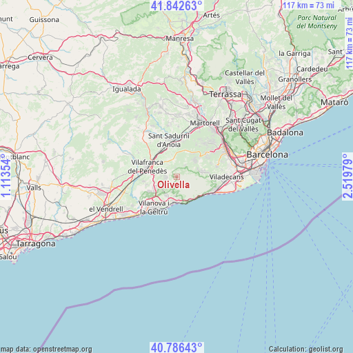
Olivella GPS coordinates[2]
41° 19' 0.012" North, 1° 49' 0.012" East
| Map corner | latitude | longitude |
|---|---|---|
| Upper-left | 41.84263°, | 1.11354° |
| Center: | 41.31667°, | 1.81667° |
| Lower-right: | 40.78643°, | 2.51979° |
| Map W x H: | 117.4×117.4 km | = 72.9×72.9mi |
| max Lat: | 43.74134° ⇑44.4% North |
| Olivella: | 41.31667° |
| min Lat: | ⇓55.6% South 27.64134° |
| min Long | Olivella | max Long |
| -18.00367° | 1.81667° | 4.2899° |
| W 92.6%⇐ | ⇒7.4% E |
Elevation
Elevation of Olivella is 207 m = 679 ft, and this is 391 m = 1283 ft below average elevation for this country.
| Max E: |
1682 m = 5518 ft | 80.8% |
| Avg. | 598 m = 1962 ft | |
| Olivella | 207 m = 679 ft | |
Min E: |
0 m = 0 ft | 19.2% |
See also: Spain elevation on elevation.city.
Geographical zone
Olivella is located in North temperate zone (between Tropic of Cancer and the Arctic Circle). Distance of this Northern Tropic circle is 1988.1 km =1235.3 mi to South.| Distance of | km | miles | from Olivella |
|---|---|---|---|
| North Pole | 5413.1 | 3363.5 | to North |
| Arctic Circle | 2807.2 | 1744.3 | to North |
| Tropic Cancer | 1988.1 | 1235.3 | to South |
| Equator | 4594 | 2854.6 | to South |


Nearby cities:
15 places around Olivella: (largest is in red/bold)
• Avinyonet del Penedès
4.6 km =2.9 mi,  323°
323°
• Begues
9.9 km =6.2 mi,  79°
79°
• Castelldefels
13.5 km =8.4 mi,  108°
108°
• Gelida
13.6 km =8.5 mi,  17°
17°
• La Granada
10.6 km =6.6 mi,  309°
309°
• Olesa de Bonesvalls
5 km =3.1 mi,  32°
32°
• Sant Pere Molanta
7.3 km =4.5 mi,  298°
298°
• Sant Pere de Ribes
7.2 km =4.5 mi,  209°
209°
• Sant Sadurní d'Anoia
12.4 km =7.7 mi,  347°
347°
• Sitges
9.1 km =5.7 mi,  182°
182°
• Subirats
9.4 km =5.8 mi,  8°
8°
• Vallirana
12.4 km =7.7 mi,  51°
51°
• Vilafranca del Penedès
10.5 km =6.5 mi,  288°
288°
• Vilanova i la Geltrú
12.8 km =8 mi,  216°
216°
• el Pla del Penedès
13.9 km =8.6 mi, 323°
Sources, notices
• [Note1] Compared only with cities in Spain existing in our database
• [Src1] Map data: © OpenStreetMap contributors (CC-BY-SA)
• [Src2] Other city data from geonames.org with taken over terms of usage.
• [Src3] Geographical zone / Annual Mean Temperature by Robert A. Rohde @ Wikipedia
