Villanueva de Jiloca geodata
Villanueva de Jiloca (Aragon) is a seat of a third-order administrative division; located in Spain in Europe/Madrid (GMT+2) time zone. With population of 80 people, there are 6136 cities with bigger population in this country. Compared to other cities in Spain, 50.4% of cities are located further ↓South; 73.9% of cities are located further ←West and 63.8% of cities have lower elevation than Villanueva de Jiloca. Note1
Administrative division(s):
- Level 1: Aragon
- Level 2: Provincia de Zaragoza
- Level 3: Villanueva de Jiloca


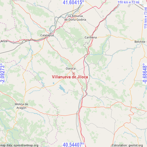
Villanueva de Jiloca GPS coordinates[2]
41° 4' 34.5" North, 1° 23' 22.56" West
| Map corner | latitude | longitude |
|---|---|---|
| Upper-left | 41.60415°, | -2.09273° |
| Center: | 41.07625°, | -1.3896° |
| Lower-right: | 40.54407°, | -0.68648° |
| Map W x H: | 117.9×117.9 km | = 73.3×73.3mi |
| max Lat: | 43.74134° ⇑49.6% North |
| Villanueva de Jiloca: | 41.07625° |
| min Lat: | ⇓50.4% South 27.64134° |
| min Long | Villanueva de J | max Long |
| -18.00367° | -1.3896° | 4.2899° |
| W 73.9%⇐ | ⇒26.1% E |
Elevation
Elevation of Villanueva de Jiloca is 770 m = 2526 ft, and this is 172 m = 564 ft above average elevation for this country.
| Max E: |
1682 m = 5518 ft | 36.2% |
| Villanueva de Jiloca | 770 m 2526 ft | |
| Avg. | 598 m = 1962 ft | |
Min E: |
0 m = 0 ft | 63.8% |
See also: Spain elevation on elevation.city.
Geographical zone
Villanueva de Jiloca is located in North temperate zone (between Tropic of Cancer and the Arctic Circle). Distance of this Northern Tropic circle is 1961.3 km =1218.7 mi to South.| Distance of | km | miles | from Villanueva de Jiloca |
|---|---|---|---|
| North Pole | 5439.8 | 3380.1 | to North |
| Arctic Circle | 2833.9 | 1760.9 | to North |
| Tropic Cancer | 1961.3 | 1218.7 | to South |
| Equator | 4567.3 | 2838 | to South |


Nearby cities:
15 places around Villanueva de Jiloca: (largest is in red/bold)
• Anento
4.7 km =2.9 mi,  99°
99°
• Balconchán
6 km =3.7 mi,  281°
281°
• Burbáguena
7.8 km =4.8 mi,  146°
146°
• Báguena
4.7 km =2.9 mi, 145°
• Castejón de Tornos
9.4 km =5.8 mi,  200°
200°
• Daroca
4.8 km =3 mi,  333°
333°
• Lechón
8.9 km =5.5 mi,  82°
82°
• Manchones
10.4 km =6.5 mi,  321°
321°
• Nombrevilla
4.3 km =2.7 mi,  36°
36°
• Orcajo
9.1 km =5.7 mi,  294°
294°
• Retascón
7.5 km =4.7 mi,  3°
3°
• San Martín del Río
1.1 km =0.7 mi,  170°
170°
• Val de San Martín
5.4 km =3.4 mi,  247°
247°
• Valdehorna
2.9 km =1.8 mi,  262°
262°
• Villarroya del Campo
9.2 km =5.7 mi, 36°
Sources, notices
• [Note1] Compared only with cities in Spain existing in our database
• [Src1] Map data: © OpenStreetMap contributors (CC-BY-SA)
• [Src2] Other city data from geonames.org with taken over terms of usage.
• [Src3] Geographical zone / Annual Mean Temperature by Robert A. Rohde @ Wikipedia
