Villafufre geodata
Villafufre (Cantabria) is a populated place; located in Spain in Europe/Madrid (GMT+2) time zone. With population of 1,109 people, there are 2817 cities with bigger population in this country. Compared to other cities in Spain, 97.1% of cities are located further ↓South; 58.1% of cities are located further →East and 79.9% of cities have higher elevation than Villafufre. Note1
Administrative division(s):
- Level 1: Cantabria
- Level 2: Provincia de Cantabria
- Level 3: Santiurde de Toranzo


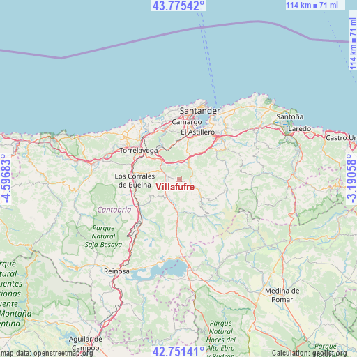
Villafufre GPS coordinates[2]
43° 15' 56.052" North, 3° 53' 37.32" West
| Map corner | latitude | longitude |
|---|---|---|
| Upper-left | 43.77542°, | -4.59683° |
| Center: | 43.26557°, | -3.8937° |
| Lower-right: | 42.75141°, | -3.19058° |
| Map W x H: | 113.9×113.9 km | = 70.8×70.8mi |
| max Lat: | 43.74134° ⇑2.9% North |
| Villafufre: | 43.26557° |
| min Lat: | ⇓97.1% South 27.64134° |
| min Long | Villafufre | max Long |
| -18.00367° | -3.8937° | 4.2899° |
| W 41.9%⇐ | ⇒58.1% E |
Elevation
Elevation of Villafufre is 222 m = 728 ft, and this is 376 m = 1234 ft below average elevation for this country.
| Max E: |
1682 m = 5518 ft | 79.9% |
| Avg. | 598 m = 1962 ft | |
| Villafufre | 222 m = 728 ft | |
Min E: |
0 m = 0 ft | 20.1% |
See also: Spain elevation on elevation.city.
Geographical zone
Villafufre is located in North temperate zone (between Tropic of Cancer and the Arctic Circle). Distance of this Northern Tropic circle is 2204.8 km =1370 mi to South.| Distance of | km | miles | from Villafufre |
|---|---|---|---|
| North Pole | 5196.4 | 3228.9 | to North |
| Arctic Circle | 2590.5 | 1609.7 | to North |
| Tropic Cancer | 2204.8 | 1370 | to South |
| Equator | 4810.7 | 2989.2 | to South |


Nearby cities:
15 places around Villafufre: (largest is in red/bold)
• Arenas de Iguña
15.5 km =9.6 mi,  233°
233°
• Camargo
15.8 km =9.8 mi,  2°
2°
• Cartes
15.7 km =9.8 mi,  295°
295°
• Liérganes
14.9 km =9.3 mi,  53°
53°
• Los Corrales de Buelna
14.5 km =9 mi,  269°
269°
• Penagos
11.6 km =7.2 mi,  33°
33°
• Puente Viesgo
7 km =4.3 mi, 301°
• Santa María de Cayón
6.6 km =4.1 mi,  43°
43°
• Santiurde de Toranzo
4.8 km =3 mi, 230°
• Saro
4.2 km =2.6 mi,  99°
99°
• Selaya
9.2 km =5.7 mi,  128°
128°
• Torrelavega
15.6 km =9.7 mi,  306°
306°
• Vega de Pas
15 km =9.3 mi,  143°
143°
• Villacarriedo
7.9 km =4.9 mi,  121°
121°
• Villanueva de Villaescusa
11.6 km =7.2 mi,  12°
12°
Sources, notices
• [Note1] Compared only with cities in Spain existing in our database
• [Src1] Map data: © OpenStreetMap contributors (CC-BY-SA)
• [Src2] Other city data from geonames.org with taken over terms of usage.
• [Src3] Geographical zone / Annual Mean Temperature by Robert A. Rohde @ Wikipedia
