Los Corrales de Buelna geodata
Los Corrales de Buelna (Cantabria) is a populated place; located in Spain in Europe/Madrid (GMT+2) time zone. With population of 11,519 people, there are 769 cities with bigger population in this country. Compared to other cities in Spain, 97.1% of cities are located further ↓South; 60.9% of cities are located further →East and 88.2% of cities have higher elevation than Los Corrales de Buelna. Note1
Administrative division(s):
- Level 1: Cantabria
- Level 2: Provincia de Cantabria
- Level 3: Corrales de Buelna, Los
Current local time in Los Corrales de Buelna:
10:42 PM, ThursdayDifference from your time zone: hours


Los Corrales de Buelna GPS coordinates[2]
43° 15' 48.888" North, 4° 4' 21.432" West
| Map corner | latitude | longitude |
|---|---|---|
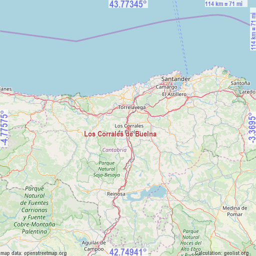
| Upper-left | 43.77345°, | -4.77575° |
| Center: | 43.26358°, | -4.07262° |
| Lower-right: | 42.74941°, | -3.3695° |
| Map W x H: | 113.9×113.9 km | = 70.8×70.8mi |
| max Lat: | 43.74134° ⇑2.9% North |
| Los Corrales de Buelna: | 43.26358° |
| min Lat: | ⇓97.1% South 27.64134° |
| min Long | Los Corrales de | max Long |
| -18.00367° | -4.07262° | 4.2899° |
| W 39.1%⇐ | ⇒60.9% E |
Elevation
Elevation of Los Corrales de Buelna is 92 m = 302 ft, and this is 506 m = 1660 ft below average elevation for this country.
| Max E: |
1682 m = 5518 ft | 88.2% |
| Avg. | 598 m = 1962 ft | |
| Los Corrales de Buelna | 92 m = 302 ft | |
Min E: |
0 m = 0 ft | 11.8% |
See also: Spain elevation on elevation.city.
Geographical zone
Los Corrales de Buelna is located in North temperate zone (between Tropic of Cancer and the Arctic Circle). Distance of this Northern Tropic circle is 2204.5 km =1369.8 mi to South.| Distance of | km | miles | from Los Corrales de Buelna |
|---|---|---|---|
| North Pole | 5196.6 | 3229 | to North |
| Arctic Circle | 2590.7 | 1609.8 | to North |
| Tropic Cancer | 2204.5 | 1369.8 | to South |
| Equator | 4810.5 | 2989.1 | to South |


Nearby cities:
15 places around Los Corrales de Buelna: (largest is in red/bold)
• Arenas de Iguña
9.2 km =5.7 mi,  167°
167°
• Bárcena de Pie de Concha
15.4 km =9.6 mi,  175°
175°
• Cabezón de la Sal
14.1 km =8.8 mi,  290°
290°
• Cartes
6.9 km =4.3 mi,  2°
2°
• Luzmela
11.6 km =7.2 mi, 288°
• Molledo
12.9 km =8 mi, 169°
• Polanco
14.3 km =8.9 mi,  18°
18°
• Puente Viesgo
9.3 km =5.8 mi,  65°
65°
• Reocín
8.6 km =5.3 mi,  348°
348°
• Ruente
15.8 km =9.8 mi,  267°
267°
• Santillana
14.2 km =8.8 mi, 348°
• Santiurde de Toranzo
11.1 km =6.9 mi,  104°
104°
• Saro
18.6 km =11.6 mi,  91°
91°
• Torrelavega
9.8 km =6.1 mi,  11°
11°
• Villafufre
14.5 km =9 mi, 89°
Sources, notices
• [Note1] Compared only with cities in Spain existing in our database
• [Src1] Map data: © OpenStreetMap contributors (CC-BY-SA)
• [Src2] Other city data from geonames.org with taken over terms of usage.
• [Src3] Geographical zone / Annual Mean Temperature by Robert A. Rohde @ Wikipedia
