Valdetorres de Jarama geodata
Valdetorres de Jarama (Madrid) is a seat of a third-order administrative division; located in Spain in Europe/Madrid (GMT+2) time zone. With population of 3,139 people, there are 1682 cities with bigger population in this country. Compared to other cities in Spain, 58.1% of cities are located further ↑North; 52.4% of cities are located further →East and 50.2% of cities have higher elevation than Valdetorres de Jarama. Note1
Administrative division(s):
- Level 1: Madrid
- Level 2: Provincia de Madrid
- Level 3: Valdetorres de Jarama
Current local time in Valdetorres de Jarama:
10:45 PM, ThursdayDifference from your time zone: hours


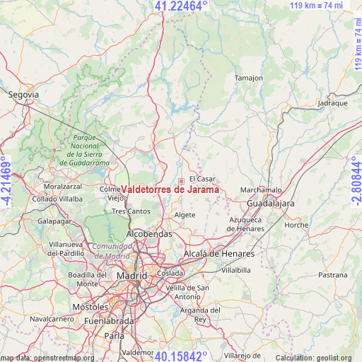
Valdetorres de Jarama GPS coordinates[2]
40° 41' 37.176" North, 3° 30' 41.616" West
| Map corner | latitude | longitude |
|---|---|---|
| Upper-left | 41.22464°, | -4.21469° |
| Center: | 40.69366°, | -3.51156° |
| Lower-right: | 40.15842°, | -2.80844° |
| Map W x H: | 118.6×118.6 km | = 73.7×73.7mi |
| max Lat: | 43.74134° ⇑58.1% North |
| Valdetorres de Jarama: | 40.69366° |
| min Lat: | ⇓41.9% South 27.64134° |
| min Long | Valdetorres de | max Long |
| -18.00367° | -3.51156° | 4.2899° |
| W 47.6%⇐ | ⇒52.4% E |
Elevation
Elevation of Valdetorres de Jarama is 655 m = 2149 ft, and this is 57 m = 187 ft above average elevation for this country.
| Max E: |
1682 m = 5518 ft | 50.2% |
| Valdetorres de Jarama | 655 m 2149 ft | |
| Avg. | 598 m = 1962 ft | |
Min E: |
0 m = 0 ft | 49.8% |
See also: Spain elevation on elevation.city.
Geographical zone
Valdetorres de Jarama is located in North temperate zone (between Tropic of Cancer and the Arctic Circle). Distance of this Northern Tropic circle is 1918.8 km =1192.3 mi to South.| Distance of | km | miles | from Valdetorres de Jarama |
|---|---|---|---|
| North Pole | 5482.4 | 3406.6 | to North |
| Arctic Circle | 2876.5 | 1787.4 | to North |
| Tropic Cancer | 1918.8 | 1192.3 | to South |
| Equator | 4524.7 | 2811.5 | to South |


Nearby cities:
15 places around Valdetorres de Jarama: (largest is in red/bold)
• Algete
10.8 km =6.7 mi,  173°
173°
• Cobeña
14.2 km =8.8 mi,  176°
176°
• El Molar
7.2 km =4.5 mi,  306°
306°
• El Vellón
9.8 km =6.1 mi,  324°
324°
• Fresno de Torote
14.3 km =8.9 mi,  143°
143°
• Fuente el Saz
6.8 km =4.2 mi, 179°
• Galápagos
14.9 km =9.3 mi,  90°
90°
• Pedrezuela
9.2 km =5.7 mi, 306°
• Ribatejada
10.8 km =6.7 mi,  107°
107°
• San Agustín del Guadalix
9 km =5.6 mi,  259°
259°
• Talamanca de Jarama
5.5 km =3.4 mi,  2°
2°
• Torrelaguna
15 km =9.3 mi,  351°
351°
• Valdeolmos
8.1 km =5 mi, 140°
• Valdepiélagos
8.3 km =5.2 mi,  30°
30°
• Venturada
14.7 km =9.1 mi, 321°
Sources, notices
• [Note1] Compared only with cities in Spain existing in our database
• [Src1] Map data: © OpenStreetMap contributors (CC-BY-SA)
• [Src2] Other city data from geonames.org with taken over terms of usage.
• [Src3] Geographical zone / Annual Mean Temperature by Robert A. Rohde @ Wikipedia
