Taboadela geodata
Taboadela (Galicia) is a seat of a third-order administrative division; located in Spain in Europe/Madrid (GMT+2) time zone. With population of 1,680 people, there are 2353 cities with bigger population in this country. Compared to other cities in Spain, 80.4% of cities are located further ↓South; 96% of cities are located further →East and 70.7% of cities have higher elevation than Taboadela. Note1


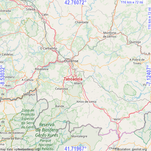
Taboadela GPS coordinates[2]
42° 14' 32.424" North, 7° 49' 37.884" West
| Map corner | latitude | longitude |
|---|---|---|
| Upper-left | 42.76072°, | -8.53032° |
| Center: | 42.24234°, | -7.82719° |
| Lower-right: | 41.71967°, | -7.12407° |
| Map W x H: | 115.8×115.8 km | = 72×72mi |
| max Lat: | 43.74134° ⇑19.6% North |
| Taboadela: | 42.24234° |
| min Lat: | ⇓80.4% South 27.64134° |
| min Long | Taboadela | max Long |
| -18.00367° | -7.82719° | 4.2899° |
| W 4%⇐ | ⇒96% E |
Elevation
Elevation of Taboadela is 370 m = 1214 ft, and this is 228 m = 748 ft below average elevation for this country.
| Max E: |
1682 m = 5518 ft | 70.7% |
| Avg. | 598 m = 1962 ft | |
| Taboadela | 370 m = 1214 ft | |
Min E: |
0 m = 0 ft | 29.3% |
See also: Spain elevation on elevation.city.
Geographical zone
Taboadela is located in North temperate zone (between Tropic of Cancer and the Arctic Circle). Distance of this Northern Tropic circle is 2091 km =1299.3 mi to South.| Distance of | km | miles | from Taboadela |
|---|---|---|---|
| North Pole | 5310.2 | 3299.6 | to North |
| Arctic Circle | 2704.3 | 1680.4 | to North |
| Tropic Cancer | 2091 | 1299.3 | to South |
| Equator | 4696.9 | 2918.5 | to South |


Nearby cities:
15 places around Taboadela: (largest is in red/bold)
• Allariz
6.1 km =3.8 mi,  160°
160°
• Ambía
8.5 km =5.3 mi,  118°
118°
• Baños de Molgas
12.8 km =8 mi,  90°
90°
• Cartelle
20.1 km =12.5 mi,  272°
272°
• Celanova
14.5 km =9 mi,  226°
226°
• Coles
17.5 km =10.9 mi,  358°
358°
• Esgos
14.2 km =8.8 mi,  49°
49°
• Luintra
20.3 km =12.6 mi,  23°
23°
• Maceda
14.9 km =9.3 mi,  78°
78°
• Nogueira de Ramuín
20.4 km =12.7 mi, 18°
• Ourense
10.9 km =6.8 mi,  343°
343°
• Pereiro de Aguiar
11.7 km =7.3 mi,  11°
11°
• Rairiz de Veiga
17.7 km =11 mi,  182°
182°
• Toén
13.4 km =8.3 mi,  308°
308°
• Vilarnaz
17.8 km =11.1 mi,  350°
350°
Sources, notices
• [Note1] Compared only with cities in Spain existing in our database
• [Src1] Map data: © OpenStreetMap contributors (CC-BY-SA)
• [Src2] Other city data from geonames.org with taken over terms of usage.
• [Src3] Geographical zone / Annual Mean Temperature by Robert A. Rohde @ Wikipedia
