Senés de Alcubierre geodata
Senés de Alcubierre (Aragon) is a seat of a third-order administrative division; located in Spain in Europe/Madrid (GMT+2) time zone. With population of 48 people, there are 6485 cities with bigger population in this country. Compared to other cities in Spain, 71.1% of cities are located further ↓South; 81.8% of cities are located further ←West and 69.6% of cities have higher elevation than Senés de Alcubierre. Note1
Administrative division(s):
- Level 1: Aragon
- Level 2: Provincia de Huesca
- Level 3: Senés de Alcubierre


Senés de Alcubierre GPS coordinates[2]
41° 54' 26.316" North, 0° 29' 20.616" West
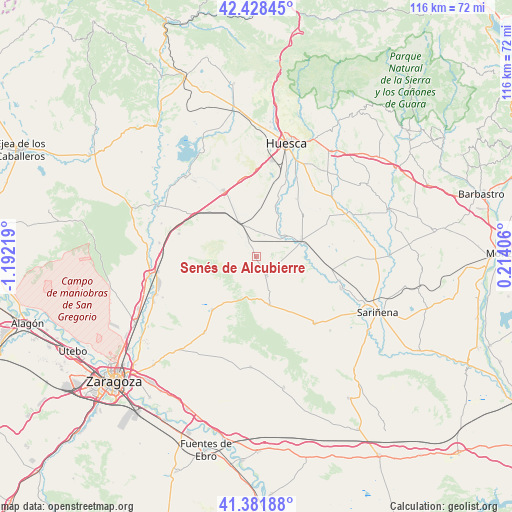
| Map corner | latitude | longitude |
|---|---|---|
| Upper-left | 42.42845°, | -1.19219° |
| Center: | 41.90731°, | -0.48906° |
| Lower-right: | 41.38188°, | 0.21406° |
| Map W x H: | 116.4×116.4 km | = 72.3×72.3mi |
| max Lat: | 43.74134° ⇑28.9% North |
| Senés de Alcubierre: | 41.90731° |
| min Lat: | ⇓71.1% South 27.64134° |
| min Long | Senés de Alcub | max Long |
| -18.00367° | -0.48906° | 4.2899° |
| W 81.8%⇐ | ⇒18.2% E |
Elevation
Elevation of Senés de Alcubierre is 390 m = 1280 ft, and this is 208 m = 682 ft below average elevation for this country.
| Max E: |
1682 m = 5518 ft | 69.6% |
| Avg. | 598 m = 1962 ft | |
| Senés de Alcubierre | 390 m = 1280 ft | |
Min E: |
0 m = 0 ft | 30.4% |
See also: Spain elevation on elevation.city.
Geographical zone
Senés de Alcubierre is located in North temperate zone (between Tropic of Cancer and the Arctic Circle). Distance of this Northern Tropic circle is 2053.7 km =1276.1 mi to South.| Distance of | km | miles | from Senés de Alcubierre |
|---|---|---|---|
| North Pole | 5347.4 | 3322.7 | to North |
| Arctic Circle | 2741.5 | 1703.5 | to North |
| Tropic Cancer | 2053.7 | 1276.1 | to South |
| Equator | 4659.7 | 2895.4 | to South |


Nearby cities:
15 places around Senés de Alcubierre: (largest is in red/bold)
• Albero Bajo
15.8 km =9.8 mi,  34°
34°
• Alcubierre
11.5 km =7.1 mi,  164°
164°
• Almudévar
16.9 km =10.5 mi,  333°
333°
• Almuniente
7.9 km =4.9 mi,  53°
53°
• Barbués
10 km =6.2 mi,  35°
35°
• Grañén
10.6 km =6.6 mi,  69°
69°
• Leciñena
15.8 km =9.8 mi,  220°
220°
• Piracés
17.8 km =11.1 mi, 52°
• Poleñino
15.4 km =9.6 mi,  105°
105°
• Robres
5 km =3.1 mi,  152°
152°
• Sangarrén
13.3 km =8.3 mi,  20°
20°
• Tardienta
8.8 km =5.5 mi, 333°
• Torralba de Aragón
3.5 km =2.2 mi, 329°
• Torres de Barbués
7.5 km =4.7 mi, 37°
• Tramaced
17.5 km =10.9 mi, 65°
Sources, notices
• [Note1] Compared only with cities in Spain existing in our database
• [Src1] Map data: © OpenStreetMap contributors (CC-BY-SA)
• [Src2] Other city data from geonames.org with taken over terms of usage.
• [Src3] Geographical zone / Annual Mean Temperature by Robert A. Rohde @ Wikipedia
