San Sebastián de los Reyes geodata
San Sebastián de los Reyes (Madrid) is a seat of a third-order administrative division; located in Spain in Europe/Madrid (GMT+2) time zone. With population of 75,912 people, there are 122 cities with bigger population in this country. Compared to other cities in Spain, 60.7% of cities are located further ↑North; 54.2% of cities are located further →East and 52.5% of cities have lower elevation than San Sebastián de los Reyes. Note1
Administrative division(s):
- Level 1: Madrid
- Level 2: Provincia de Madrid
- Level 3: San Sebastián de los Reyes
Current local time in San Sebastián de los Reyes:
10:42 PM, ThursdayDifference from your time zone: hours


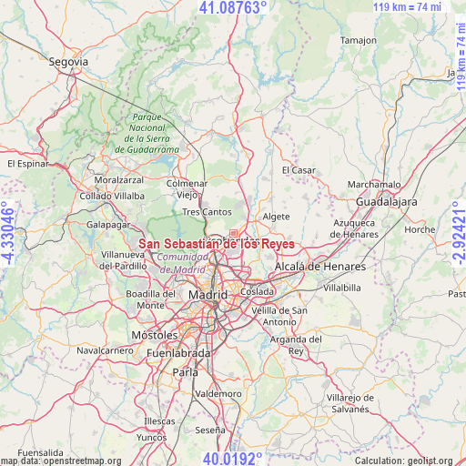
San Sebastián de los Reyes GPS coordinates[2]
40° 33' 19.98" North, 3° 37' 38.388" West
| Map corner | latitude | longitude |
|---|---|---|
| Upper-left | 41.08763°, | -4.33046° |
| Center: | 40.55555°, | -3.62733° |
| Lower-right: | 40.0192°, | -2.92421° |
| Map W x H: | 118.8×118.8 km | = 73.8×73.8mi |
| max Lat: | 43.74134° ⇑60.7% North |
| San Sebastián de los Reyes: | 40.55555° |
| min Lat: | ⇓39.3% South 27.64134° |
| min Long | San Sebastián | max Long |
| -18.00367° | -3.62733° | 4.2899° |
| W 45.8%⇐ | ⇒54.2% E |
Elevation
Elevation of San Sebastián de los Reyes is 685 m = 2247 ft, and this is 87 m = 285 ft above average elevation for this country.
| Max E: |
1682 m = 5518 ft | 47.5% |
| San Sebastián de los Reyes | 685 m 2247 ft | |
| Avg. | 598 m = 1962 ft | |
Min E: |
0 m = 0 ft | 52.5% |
See also: San Sebastián de los Reyes elevation on elevation.city.
Geographical zone
San Sebastián de los Reyes is located in North temperate zone (between Tropic of Cancer and the Arctic Circle). Distance of this Northern Tropic circle is 1903.4 km =1182.7 mi to South.| Distance of | km | miles | from San Sebastián de los Reyes |
|---|---|---|---|
| North Pole | 5497.7 | 3416.1 | to North |
| Arctic Circle | 2891.8 | 1796.9 | to North |
| Tropic Cancer | 1903.4 | 1182.7 | to South |
| Equator | 4509.4 | 2802 | to South |


Nearby cities:
15 places around San Sebastián de los Reyes: (largest is in red/bold)
• Ajalvir
12.9 km =8 mi,  101°
101°
• Alcobendas
1.5 km =0.9 mi,  233°
233°
• Algete
11.9 km =7.4 mi,  67°
67°
• Barajas de Madrid
10 km =6.2 mi,  155°
155°
• Chamartín
11.2 km =7 mi,  201°
201°
• Ciudad Lineal
12.5 km =7.8 mi,  189°
189°
• Cobeña
10.8 km =6.7 mi,  83°
83°
• Fuencarral-El Pardo
10.9 km =6.8 mi, 234°
• Fuente el Saz
13 km =8.1 mi,  48°
48°
• Hortaleza
9.1 km =5.7 mi, 187°
• Las Tablas
6.7 km =4.2 mi,  214°
214°
• Paracuellos de Jarama
10.2 km =6.3 mi,  124°
124°
• Pinar de Chamartín
9.2 km =5.7 mi, 202°
• Tetuán de las Victorias
12.2 km =7.6 mi, 209°
• Tres Cantos
8.5 km =5.3 mi,  306°
306°
Sources, notices
• [Note1] Compared only with cities in Spain existing in our database
• [Src1] Map data: © OpenStreetMap contributors (CC-BY-SA)
• [Src2] Other city data from geonames.org with taken over terms of usage.
• [Src3] Geographical zone / Annual Mean Temperature by Robert A. Rohde @ Wikipedia
