San Mateo de Gállego geodata
San Mateo de Gállego (Aragon) is a seat of a third-order administrative division; located in Spain in Europe/Madrid (GMT+2) time zone. With population of 2,461 people, there are 1914 cities with bigger population in this country. Compared to other cities in Spain, 69.4% of cities are located further ↓South; 79.3% of cities are located further ←West and 75.9% of cities have higher elevation than San Mateo de Gállego. Note1
Administrative division(s):
- Level 1: Aragon
- Level 2: Provincia de Zaragoza
- Level 3: San Mateo de Gállego


San Mateo de Gállego GPS coordinates[2]
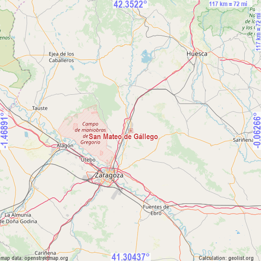
41° 49' 49.548" North, 0° 45' 56.808" West
| Map corner | latitude | longitude |
|---|---|---|
| Upper-left | 42.3522°, | -1.46891° |
| Center: | 41.83043°, | -0.76578° |
| Lower-right: | 41.30437°, | -0.06266° |
| Map W x H: | 116.5×116.5 km | = 72.4×72.4mi |
| max Lat: | 43.74134° ⇑30.6% North |
| San Mateo de Gállego: | 41.83043° |
| min Lat: | ⇓69.4% South 27.64134° |
| min Long | San Mateo de G� | max Long |
| -18.00367° | -0.76578° | 4.2899° |
| W 79.3%⇐ | ⇒20.7% E |
Elevation
Elevation of San Mateo de Gállego is 286 m = 938 ft, and this is 312 m = 1024 ft below average elevation for this country.
| Max E: |
1682 m = 5518 ft | 75.9% |
| Avg. | 598 m = 1962 ft | |
| San Mateo de Gállego | 286 m = 938 ft | |
Min E: |
0 m = 0 ft | 24.1% |
See also: Spain elevation on elevation.city.
Geographical zone
San Mateo de Gállego is located in North temperate zone (between Tropic of Cancer and the Arctic Circle). Distance of this Northern Tropic circle is 2045.2 km =1270.8 mi to South.| Distance of | km | miles | from San Mateo de Gállego |
|---|---|---|---|
| North Pole | 5356 | 3328.1 | to North |
| Arctic Circle | 2750.1 | 1708.8 | to North |
| Tropic Cancer | 2045.2 | 1270.8 | to South |
| Equator | 4651.1 | 2890.1 | to South |


Nearby cities:
15 places around San Mateo de Gállego: (largest is in red/bold)
• Alfajarín
24.6 km =15.3 mi,  167°
167°
• Almozara
21.9 km =13.6 mi,  210°
210°
• Delicias
23.3 km =14.5 mi, 210°
• Gurrea de Gállego
20.6 km =12.8 mi,  0°
0°
• Leciñena
13.2 km =8.2 mi,  105°
105°
• Ontinar de Salz
11.7 km =7.3 mi, 3°
• Perdiguera
14 km =8.7 mi,  127°
127°
• Puebla de Alfindén
22.1 km =13.7 mi,  176°
176°
• Senés de Alcubierre
24.5 km =15.2 mi,  69°
69°
• Torralba de Aragón
24.1 km =15 mi,  61°
61°
• Utebo
23.6 km =14.7 mi,  234°
234°
• Villamayor de Gállego
16.1 km =10 mi, 181°
• Villanueva de Gállego
8.3 km =5.2 mi,  215°
215°
• Zaragoza
21.5 km =13.4 mi, 205°
• Zuera
4.6 km =2.9 mi,  334°
334°
Sources, notices
• [Note1] Compared only with cities in Spain existing in our database
• [Src1] Map data: © OpenStreetMap contributors (CC-BY-SA)
• [Src2] Other city data from geonames.org with taken over terms of usage.
• [Src3] Geographical zone / Annual Mean Temperature by Robert A. Rohde @ Wikipedia
