Áibar geodata
Áibar (Navarre) is a populated place; located in Spain in Europe/Madrid (GMT+2) time zone. With population of 925 people, there are 3045 cities with bigger population in this country. Compared to other cities in Spain, 89.4% of cities are located further ↓South; 74.2% of cities are located further ←West and 58.8% of cities have higher elevation than Áibar. Note1


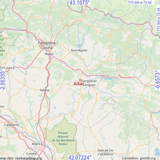
Áibar GPS coordinates[2]
42° 35' 31.272" North, 1° 21' 37.512" West
| Map corner | latitude | longitude |
|---|---|---|
| Upper-left | 43.1075°, | -2.06355° |
| Center: | 42.59202°, | -1.36042° |
| Lower-right: | 42.07224°, | -0.6573° |
| Map W x H: | 115.1×115.1 km | = 71.5×71.5mi |
| max Lat: | 43.74134° ⇑10.6% North |
| Áibar: | 42.59202° |
| min Lat: | ⇓89.4% South 27.64134° |
| min Long | Áibar | max Long |
| -18.00367° | -1.36042° | 4.2899° |
| W 74.2%⇐ | ⇒25.8% E |
Elevation
Elevation of Áibar is 543 m = 1781 ft, and this is 55 m = 180 ft below average elevation for this country.
| Max E: |
1682 m = 5518 ft | 58.8% |
| Avg. | 598 m = 1962 ft | |
| Áibar | 543 m = 1781 ft | |
Min E: |
0 m = 0 ft | 41.2% |
See also: Spain elevation on elevation.city.
Geographical zone
Áibar is located in North temperate zone (between Tropic of Cancer and the Arctic Circle). Distance of this Northern Tropic circle is 2129.9 km =1323.5 mi to South.| Distance of | km | miles | from Áibar |
|---|---|---|---|
| North Pole | 5271.3 | 3275.4 | to North |
| Arctic Circle | 2665.4 | 1656.2 | to North |
| Tropic Cancer | 2129.9 | 1323.5 | to South |
| Equator | 4735.8 | 2942.7 | to South |


Nearby cities:
15 places around Áibar: (largest is in red/bold)
• Cáseda
7.7 km =4.8 mi,  183°
183°
• Eslava
8.7 km =5.4 mi,  249°
249°
• Gallipienzo
8.6 km =5.3 mi,  208°
208°
• Javier
12.4 km =7.7 mi,  90°
90°
• Leache
4.2 km =2.6 mi,  293°
293°
• Lerga
11.8 km =7.3 mi,  256°
256°
• Liédena
7.6 km =4.7 mi,  66°
66°
• Lumbier
8.1 km =5 mi,  32°
32°
• Monreal
17.3 km =10.7 mi,  315°
315°
• San Martín de Unx
18 km =11.2 mi, 245°
• Sangüesa/Zangoza
6.6 km =4.1 mi,  106°
106°
• Sos del Rey Católico
15.9 km =9.9 mi,  131°
131°
• Ujué
15.3 km =9.5 mi,  228°
228°
• Undués de Lerda
15.9 km =9.9 mi,  100°
100°
• Yesa
13.2 km =8.2 mi,  76°
76°
Sources, notices
• [Note1] Compared only with cities in Spain existing in our database
• [Src1] Map data: © OpenStreetMap contributors (CC-BY-SA)
• [Src2] Other city data from geonames.org with taken over terms of usage.
• [Src3] Geographical zone / Annual Mean Temperature by Robert A. Rohde @ Wikipedia
