Mataporquera geodata
Mataporquera (Cantabria) is a populated place; located in Spain in Europe/Madrid (GMT+2) time zone. With population of 1,323 people, there are 2621 cities with bigger population in this country. Compared to other cities in Spain, 93.4% of cities are located further ↓South; 62.1% of cities are located further →East and 82.9% of cities have lower elevation than Mataporquera. Note1


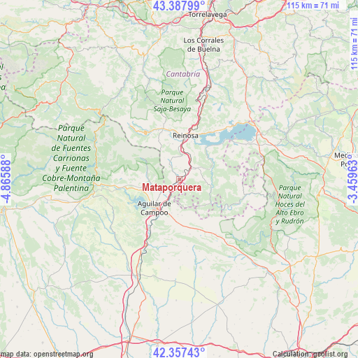
Mataporquera GPS coordinates[2]
42° 52' 29.496" North, 4° 9' 45.936" West
| Map corner | latitude | longitude |
|---|---|---|
| Upper-left | 43.38799°, | -4.86588° |
| Center: | 42.87486°, | -4.16276° |
| Lower-right: | 42.35743°, | -3.45963° |
| Map W x H: | 114.6×114.6 km | = 71.2×71.2mi |
| max Lat: | 43.74134° ⇑6.6% North |
| Mataporquera: | 42.87486° |
| min Lat: | ⇓93.4% South 27.64134° |
| min Long | Mataporquera | max Long |
| -18.00367° | -4.16276° | 4.2899° |
| W 37.9%⇐ | ⇒62.1% E |
Elevation
Elevation of Mataporquera is 927 m = 3041 ft, and this is 329 m = 1079 ft above average elevation for this country.
| Max E: |
1682 m = 5518 ft | 17.1% |
| Mataporquera | 927 m 3041 ft | |
| Avg. | 598 m = 1962 ft | |
Min E: |
0 m = 0 ft | 82.9% |
See also: Spain elevation on elevation.city.
Geographical zone
Mataporquera is located in North temperate zone (between Tropic of Cancer and the Arctic Circle). Distance of this Northern Tropic circle is 2161.3 km =1343 mi to South.| Distance of | km | miles | from Mataporquera |
|---|---|---|---|
| North Pole | 5239.8 | 3255.9 | to North |
| Arctic Circle | 2633.9 | 1636.6 | to North |
| Tropic Cancer | 2161.3 | 1343 | to South |
| Equator | 4767.2 | 2962.2 | to South |


Nearby cities:
15 places around Mataporquera: (largest is in red/bold)
• Aguilar de Campoo
11.9 km =7.4 mi,  221°
221°
• Arija
22.1 km =13.7 mi,  53°
53°
• Barruelo de Santullán
10.6 km =6.6 mi,  289°
289°
• Basconcillos del Tozo
23.8 km =14.8 mi,  143°
143°
• Berzosilla
14.6 km =9.1 mi, 135°
• Brañosera
13.7 km =8.5 mi,  299°
299°
• Mudá
18.9 km =11.7 mi,  270°
270°
• Pomar de Valdivia
11.2 km =7 mi,  182°
182°
• Rebolledo de la Torre
21.3 km =13.2 mi,  194°
194°
• Reinosa
14 km =8.7 mi,  8°
8°
• Salinas de Pisuerga
17.7 km =11 mi,  261°
261°
• San Cebrián de Mudá
18.4 km =11.4 mi,  276°
276°
• San Miguel de Aguayo
22.8 km =14.2 mi,  29°
29°
• Santiurde de Reinosa
21.7 km =13.5 mi,  17°
17°
• Villaescusa
9.8 km =6.1 mi,  357°
357°
Sources, notices
• [Note1] Compared only with cities in Spain existing in our database
• [Src1] Map data: © OpenStreetMap contributors (CC-BY-SA)
• [Src2] Other city data from geonames.org with taken over terms of usage.
• [Src3] Geographical zone / Annual Mean Temperature by Robert A. Rohde @ Wikipedia
