Longares geodata
Longares (Aragon) is a seat of a third-order administrative division; located in Spain in Europe/Madrid (GMT+2) time zone. With population of 850 people, there are 3131 cities with bigger population in this country. Compared to other cities in Spain, 57.9% of cities are located further ↓South; 75.9% of cities are located further ←West and 59.3% of cities have higher elevation than Longares. Note1


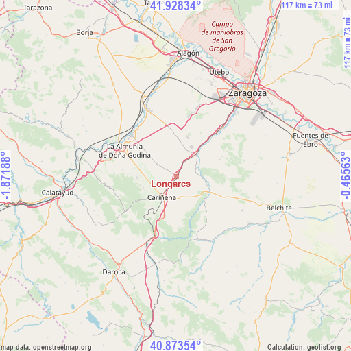
Longares GPS coordinates[2]
41° 24' 11.088" North, 1° 10' 7.536" West
| Map corner | latitude | longitude |
|---|---|---|
| Upper-left | 41.92834°, | -1.87188° |
| Center: | 41.40308°, | -1.16876° |
| Lower-right: | 40.87354°, | -0.46563° |
| Map W x H: | 117.3×117.3 km | = 72.9×72.9mi |
| max Lat: | 43.74134° ⇑42.1% North |
| Longares: | 41.40308° |
| min Lat: | ⇓57.9% South 27.64134° |
| min Long | Longares | max Long |
| -18.00367° | -1.16876° | 4.2899° |
| W 75.9%⇐ | ⇒24.1% E |
Elevation
Elevation of Longares is 536 m = 1759 ft, and this is 62 m = 203 ft below average elevation for this country.
| Max E: |
1682 m = 5518 ft | 59.3% |
| Avg. | 598 m = 1962 ft | |
| Longares | 536 m = 1759 ft | |
Min E: |
0 m = 0 ft | 40.7% |
See also: Spain elevation on elevation.city.
Geographical zone
Longares is located in North temperate zone (between Tropic of Cancer and the Arctic Circle). Distance of this Northern Tropic circle is 1997.7 km =1241.3 mi to South.| Distance of | km | miles | from Longares |
|---|---|---|---|
| North Pole | 5403.5 | 3357.6 | to North |
| Arctic Circle | 2797.6 | 1738.3 | to North |
| Tropic Cancer | 1997.7 | 1241.3 | to South |
| Equator | 4603.6 | 2860.5 | to South |


Nearby cities:
15 places around Longares: (largest is in red/bold)
• Aguarón
11.1 km =6.9 mi,  230°
230°
• Aguilón
15.8 km =9.8 mi,  139°
139°
• Alfamén
7.5 km =4.7 mi,  302°
302°
• Almonacid de la Sierra
13 km =8.1 mi,  267°
267°
• Botorrita
16.3 km =10.1 mi,  44°
44°
• Cariñena
8.7 km =5.4 mi,  212°
212°
• Cosuenda
11.6 km =7.2 mi,  248°
248°
• Encinacorba
15.8 km =9.8 mi, 214°
• Jaulín
15.7 km =9.8 mi,  69°
69°
• Mezalocha
7.6 km =4.7 mi, 70°
• Mozota
12.3 km =7.6 mi, 42°
• Muel
9.9 km =6.2 mi, 44°
• Paniza
13.7 km =8.5 mi,  195°
195°
• Tosos
12.6 km =7.8 mi, 140°
• Villanueva del Huerva
12.3 km =7.6 mi,  116°
116°
Sources, notices
• [Note1] Compared only with cities in Spain existing in our database
• [Src1] Map data: © OpenStreetMap contributors (CC-BY-SA)
• [Src2] Other city data from geonames.org with taken over terms of usage.
• [Src3] Geographical zone / Annual Mean Temperature by Robert A. Rohde @ Wikipedia
