Cuntis geodata
Cuntis (Galicia) is a seat of a third-order administrative division; located in Spain in Europe/Madrid (GMT+2) time zone. With population of 5,398 people, there are 1232 cities with bigger population in this country. Compared to other cities in Spain, 90.3% of cities are located further ↓South; 97.4% of cities are located further →East and 83.3% of cities have higher elevation than Cuntis. Note1


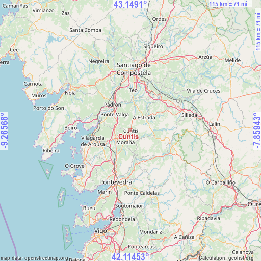
Cuntis GPS coordinates[2]
42° 38' 2.256" North, 8° 33' 45.216" West
| Map corner | latitude | longitude |
|---|---|---|
| Upper-left | 43.1491°, | -9.26568° |
| Center: | 42.63396°, | -8.56256° |
| Lower-right: | 42.11453°, | -7.85943° |
| Map W x H: | 115×115 km | = 71.5×71.5mi |
| max Lat: | 43.74134° ⇑9.7% North |
| Cuntis: | 42.63396° |
| min Lat: | ⇓90.3% South 27.64134° |
| min Long | Cuntis | max Long |
| -18.00367° | -8.56256° | 4.2899° |
| W 2.6%⇐ | ⇒97.4% E |
Elevation
Elevation of Cuntis is 164 m = 538 ft, and this is 434 m = 1424 ft below average elevation for this country.
| Max E: |
1682 m = 5518 ft | 83.3% |
| Avg. | 598 m = 1962 ft | |
| Cuntis | 164 m = 538 ft | |
Min E: |
0 m = 0 ft | 16.7% |
See also: Spain elevation on elevation.city.
Geographical zone
Cuntis is located in North temperate zone (between Tropic of Cancer and the Arctic Circle). Distance of this Northern Tropic circle is 2134.5 km =1326.3 mi to South.| Distance of | km | miles | from Cuntis |
|---|---|---|---|
| North Pole | 5266.6 | 3272.5 | to North |
| Arctic Circle | 2660.7 | 1653.3 | to North |
| Tropic Cancer | 2134.5 | 1326.3 | to South |
| Equator | 4740.5 | 2945.6 | to South |


Nearby cities:
15 places around Cuntis: (largest is in red/bold)
• A Estrada
8.6 km =5.3 mi,  44°
44°
• Barro
10 km =6.2 mi,  209°
209°
• Caldas de Reis
7.3 km =4.5 mi,  243°
243°
• Catoira
13.7 km =8.5 mi,  285°
285°
• Forcarei
17.9 km =11.1 mi,  104°
104°
• Moraña
9.5 km =5.9 mi,  190°
190°
• Padrón
14.1 km =8.8 mi,  325°
325°
• Portas
9.3 km =5.8 mi,  234°
234°
• Ribeira
15.8 km =9.8 mi, 37°
• Rois
18.5 km =11.5 mi,  320°
320°
• Sobradelo
18.9 km =11.7 mi,  252°
252°
• Teo
13.9 km =8.6 mi,  21°
21°
• Valga
9.5 km =5.9 mi, 318°
• Vedra
17.5 km =10.9 mi, 23°
• Vilagarcía de Arousa
17 km =10.6 mi,  255°
255°
Sources, notices
• [Note1] Compared only with cities in Spain existing in our database
• [Src1] Map data: © OpenStreetMap contributors (CC-BY-SA)
• [Src2] Other city data from geonames.org with taken over terms of usage.
• [Src3] Geographical zone / Annual Mean Temperature by Robert A. Rohde @ Wikipedia
