A Estrada geodata
A Estrada (Galicia) is a populated place; located in Spain in Europe/Madrid (GMT+2) time zone. With population of 21,880 people, there are 432 cities with bigger population in this country. Compared to other cities in Spain, 91.3% of cities are located further ↓South; 97.3% of cities are located further →East and 74.6% of cities have higher elevation than A Estrada. Note1


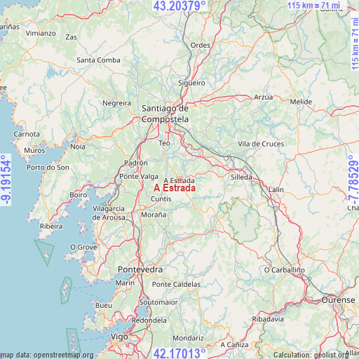
A Estrada GPS coordinates[2]
42° 41' 20.796" North, 8° 29' 18.312" West
| Map corner | latitude | longitude |
|---|---|---|
| Upper-left | 43.20379°, | -9.19154° |
| Center: | 42.68911°, | -8.48842° |
| Lower-right: | 42.17013°, | -7.78529° |
| Map W x H: | 114.9×114.9 km | = 71.4×71.4mi |
| max Lat: | 43.74134° ⇑8.7% North |
| A Estrada: | 42.68911° |
| min Lat: | ⇓91.3% South 27.64134° |
| min Long | A Estrada | max Long |
| -18.00367° | -8.48842° | 4.2899° |
| W 2.7%⇐ | ⇒97.3% E |
Elevation
Elevation of A Estrada is 301 m = 988 ft, and this is 297 m = 974 ft below average elevation for this country.
| Max E: |
1682 m = 5518 ft | 74.6% |
| Avg. | 598 m = 1962 ft | |
| A Estrada | 301 m = 988 ft | |
Min E: |
0 m = 0 ft | 25.4% |
See also: Spain elevation on elevation.city.
Geographical zone
A Estrada is located in North temperate zone (between Tropic of Cancer and the Arctic Circle). Distance of this Northern Tropic circle is 2140.7 km =1330.2 mi to South.| Distance of | km | miles | from A Estrada |
|---|---|---|---|
| North Pole | 5260.5 | 3268.7 | to North |
| Arctic Circle | 2654.6 | 1649.5 | to North |
| Tropic Cancer | 2140.7 | 1330.2 | to South |
| Equator | 4746.6 | 2949.4 | to South |


Nearby cities:
15 places around A Estrada: (largest is in red/bold)
• Barro
18.5 km =11.5 mi,  216°
216°
• Caldas de Reis
15.7 km =9.8 mi,  233°
233°
• Catoira
19.3 km =12 mi,  262°
262°
• Cuntis
8.6 km =5.3 mi, 224°
• Forcarei
15.6 km =9.7 mi,  133°
133°
• Moraña
17.3 km =10.7 mi,  206°
206°
• Padrón
15.1 km =9.4 mi,  291°
291°
• Portas
17.9 km =11.1 mi, 229°
• Ribeira
7.3 km =4.5 mi,  29°
29°
• Rois
19.5 km =12.1 mi, 294°
• Santiago de Compostela
21.8 km =13.5 mi,  347°
347°
• Silleda
19.8 km =12.3 mi,  87°
87°
• Teo
6.8 km =4.2 mi, 352°
• Valga
12.4 km =7.7 mi,  274°
274°
• Vedra
10 km =6.2 mi,  5°
5°
Sources, notices
• [Note1] Compared only with cities in Spain existing in our database
• [Src1] Map data: © OpenStreetMap contributors (CC-BY-SA)
• [Src2] Other city data from geonames.org with taken over terms of usage.
• [Src3] Geographical zone / Annual Mean Temperature by Robert A. Rohde @ Wikipedia
