Vedra geodata
Vedra (Galicia) is a seat of a third-order administrative division; located in Spain in Europe/Madrid (GMT+2) time zone. With population of 5,069 people, there are 1287 cities with bigger population in this country. Compared to other cities in Spain, 92.4% of cities are located further ↓South; 97.2% of cities are located further →East and 81.7% of cities have higher elevation than Vedra. Note1


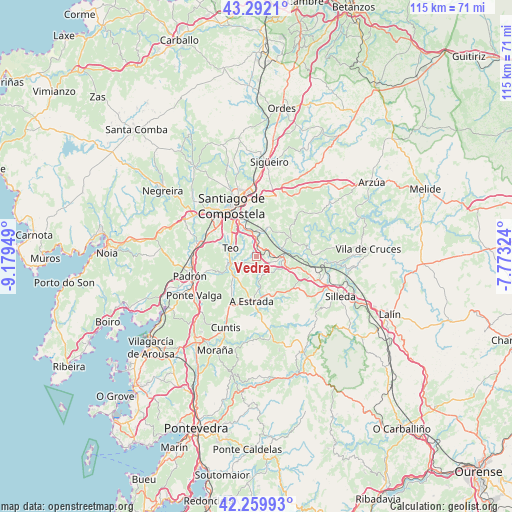
Vedra GPS coordinates[2]
42° 46' 41.412" North, 8° 28' 34.896" West
| Map corner | latitude | longitude |
|---|---|---|
| Upper-left | 43.2921°, | -9.17949° |
| Center: | 42.77817°, | -8.47636° |
| Lower-right: | 42.25993°, | -7.77324° |
| Map W x H: | 114.8×114.8 km | = 71.3×71.3mi |
| max Lat: | 43.74134° ⇑7.6% North |
| Vedra: | 42.77817° |
| min Lat: | ⇓92.4% South 27.64134° |
| min Long | Vedra | max Long |
| -18.00367° | -8.47636° | 4.2899° |
| W 2.8%⇐ | ⇒97.2% E |
Elevation
Elevation of Vedra is 192 m = 630 ft, and this is 406 m = 1332 ft below average elevation for this country.
| Max E: |
1682 m = 5518 ft | 81.7% |
| Avg. | 598 m = 1962 ft | |
| Vedra | 192 m = 630 ft | |
Min E: |
0 m = 0 ft | 18.3% |
See also: Spain elevation on elevation.city.
Geographical zone
Vedra is located in North temperate zone (between Tropic of Cancer and the Arctic Circle). Distance of this Northern Tropic circle is 2150.6 km =1336.3 mi to South.| Distance of | km | miles | from Vedra |
|---|---|---|---|
| North Pole | 5250.6 | 3262.6 | to North |
| Arctic Circle | 2644.7 | 1643.3 | to North |
| Tropic Cancer | 2150.6 | 1336.3 | to South |
| Equator | 4756.5 | 2955.6 | to South |


Nearby cities:
15 places around Vedra: (largest is in red/bold)
• A Estrada
10 km =6.2 mi,  185°
185°
• Amés
20.2 km =12.6 mi,  313°
313°
• Caldas de Reis
23.6 km =14.7 mi,  215°
215°
• Catoira
23.6 km =14.7 mi,  238°
238°
• Cuntis
17.5 km =10.9 mi,  203°
203°
• Forcarei
23.1 km =14.4 mi,  153°
153°
• Oroso
23.1 km =14.4 mi,  8°
8°
• Padrón
15.7 km =9.8 mi,  253°
253°
• Ribeira
4.4 km =2.7 mi,  143°
143°
• Rois
18.8 km =11.7 mi,  264°
264°
• Santiago de Compostela
12.7 km =7.9 mi,  333°
333°
• Silleda
20.9 km =13 mi,  115°
115°
• Teo
3.7 km =2.3 mi,  211°
211°
• Touro
17 km =10.6 mi,  53°
53°
• Valga
16 km =9.9 mi, 236°
Sources, notices
• [Note1] Compared only with cities in Spain existing in our database
• [Src1] Map data: © OpenStreetMap contributors (CC-BY-SA)
• [Src2] Other city data from geonames.org with taken over terms of usage.
• [Src3] Geographical zone / Annual Mean Temperature by Robert A. Rohde @ Wikipedia
