Cordovilla geodata
Cordovilla (Castille and León) is a seat of a third-order administrative division; located in Spain in Europe/Madrid (GMT+2) time zone. With population of 133 people, there are 5556 cities with bigger population in this country. Compared to other cities in Spain, 52.8% of cities are located further ↑North; 77.5% of cities are located further →East and 71.6% of cities have lower elevation than Cordovilla. Note1
Administrative division(s):
- Level 1: Castille and León
- Level 2: Provincia de Salamanca
- Level 3: Cordovilla


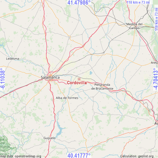
Cordovilla GPS coordinates[2]
40° 57' 3.42" North, 5° 24' 26.1" West
| Map corner | latitude | longitude |
|---|---|---|
| Upper-left | 41.47986°, | -6.11038° |
| Center: | 40.95095°, | -5.40725° |
| Lower-right: | 40.41777°, | -4.70413° |
| Map W x H: | 118.1×118.1 km | = 73.4×73.4mi |
| max Lat: | 43.74134° ⇑52.8% North |
| Cordovilla: | 40.95095° |
| min Lat: | ⇓47.2% South 27.64134° |
| min Long | Cordovilla | max Long |
| -18.00367° | -5.40725° | 4.2899° |
| W 22.5%⇐ | ⇒77.5% E |
Elevation
Elevation of Cordovilla is 825 m = 2707 ft, and this is 227 m = 745 ft above average elevation for this country.
| Max E: |
1682 m = 5518 ft | 28.4% |
| Cordovilla | 825 m 2707 ft | |
| Avg. | 598 m = 1962 ft | |
Min E: |
0 m = 0 ft | 71.6% |
See also: Spain elevation on elevation.city.
Geographical zone
Cordovilla is located in North temperate zone (between Tropic of Cancer and the Arctic Circle). Distance of this Northern Tropic circle is 1947.4 km =1210.1 mi to South.| Distance of | km | miles | from Cordovilla |
|---|---|---|---|
| North Pole | 5453.7 | 3388.8 | to North |
| Arctic Circle | 2847.9 | 1769.6 | to North |
| Tropic Cancer | 1947.4 | 1210.1 | to South |
| Equator | 4553.3 | 2829.3 | to South |


Nearby cities:
15 places around Cordovilla: (largest is in red/bold)
• Alconada
5.8 km =3.6 mi,  140°
140°
• Aldearrubia
9.9 km =6.2 mi,  309°
309°
• Babilafuente
3.3 km =2.1 mi,  332°
332°
• Coca de Alba
8.8 km =5.5 mi,  156°
156°
• Encinas de Abajo
5.6 km =3.5 mi,  251°
251°
• Garcihernández
10.3 km =6.4 mi,  193°
193°
• Huerta
5.4 km =3.4 mi,  290°
290°
• Machacón
10.2 km =6.3 mi, 254°
• Peñarandilla
7.6 km =4.7 mi,  171°
171°
• San Morales
9.3 km =5.8 mi,  300°
300°
• Ventosa del Río Almar
5.6 km =3.5 mi,  118°
118°
• Villagonzalo de Tormes
10 km =6.2 mi,  228°
228°
• Villar de Gallimazo
10 km =6.2 mi,  88°
88°
• Villoruela
6.5 km =4 mi,  9°
9°
• Villoría
5.6 km =3.5 mi,  30°
30°
Sources, notices
• [Note1] Compared only with cities in Spain existing in our database
• [Src1] Map data: © OpenStreetMap contributors (CC-BY-SA)
• [Src2] Other city data from geonames.org with taken over terms of usage.
• [Src3] Geographical zone / Annual Mean Temperature by Robert A. Rohde @ Wikipedia
