Natahoyo geodata
Natahoyo (Asturias) is a populated place; located in Spain in Europe/Madrid (GMT+2) time zone. With population of 20,000 people, there are 477 cities with bigger population in this country. Compared to other cities in Spain, 99.7% of cities are located further ↓South; 81.4% of cities are located further →East and 98.7% of cities have higher elevation than Natahoyo. Note1


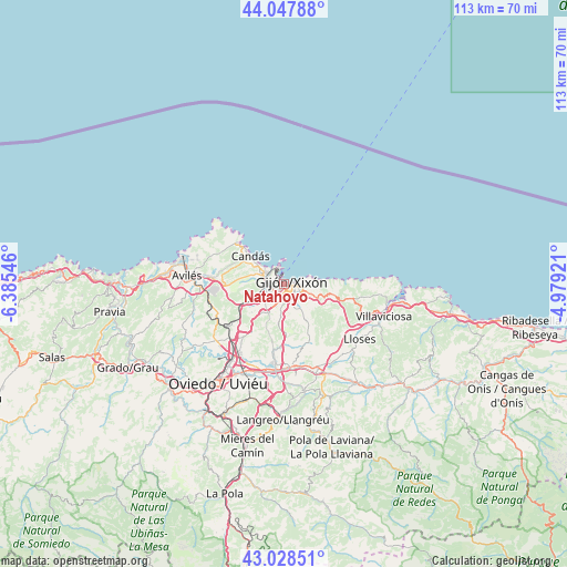
Natahoyo GPS coordinates[2]
43° 32' 25.26" North, 5° 40' 56.388" West
| Map corner | latitude | longitude |
|---|---|---|
| Upper-left | 44.04788°, | -6.38546° |
| Center: | 43.54035°, | -5.68233° |
| Lower-right: | 43.02851°, | -4.97921° |
| Map W x H: | 113.3×113.3 km | = 70.4×70.4mi |
| max Lat: | 43.74134° ⇑0.3% North |
| Natahoyo: | 43.54035° |
| min Lat: | ⇓99.7% South 27.64134° |
| min Long | Natahoyo | max Long |
| -18.00367° | -5.68233° | 4.2899° |
| W 18.6%⇐ | ⇒81.4% E |
Elevation
Elevation of Natahoyo is 9 m = 30 ft, and this is 589 m = 1932 ft below average elevation for this country.
| Max E: |
1682 m = 5518 ft | 98.7% |
| Avg. | 598 m = 1962 ft | |
| Natahoyo | 9 m = 30 ft | |
Min E: |
0 m = 0 ft | 1.3% |
See also: Spain elevation on elevation.city.
Geographical zone
Natahoyo is located in North temperate zone (between Tropic of Cancer and the Arctic Circle). Distance of this Northern Tropic circle is 2235.3 km =1389 mi to South.| Distance of | km | miles | from Natahoyo |
|---|---|---|---|
| North Pole | 5165.8 | 3209.9 | to North |
| Arctic Circle | 2559.9 | 1590.6 | to North |
| Tropic Cancer | 2235.3 | 1389 | to South |
| Equator | 4841.2 | 3008.2 | to South |


Nearby cities:
15 places around Natahoyo: (largest is in red/bold)
• Arriba
12.2 km =7.6 mi,  102°
102°
• Avilés
19.6 km =12.2 mi,  274°
274°
• Corvera de Asturias
16.7 km =10.4 mi, 268°
• Gijón
1.8 km =1.1 mi,  107°
107°
• Illas
24.1 km =15 mi,  258°
258°
• Llanera
20.1 km =12.5 mi,  233°
233°
• Llanera
21.9 km =13.6 mi,  246°
246°
• Luanco
12.2 km =7.6 mi,  312°
312°
• Lugones
18.5 km =11.5 mi,  214°
214°
• Noreña
16.4 km =10.2 mi,  186°
186°
• Oviedo
23.9 km =14.9 mi, 213°
• Piedras Blancas
23.7 km =14.7 mi,  275°
275°
• Pola de Siero
16.5 km =10.3 mi,  174°
174°
• Sariego
19.7 km =12.2 mi,  142°
142°
• Villaviciosa
20.9 km =13 mi, 108°
Sources, notices
• [Note1] Compared only with cities in Spain existing in our database
• [Src1] Map data: © OpenStreetMap contributors (CC-BY-SA)
• [Src2] Other city data from geonames.org with taken over terms of usage.
• [Src3] Geographical zone / Annual Mean Temperature by Robert A. Rohde @ Wikipedia
