Sievi geodata
Sievi (Northern Ostrobothnia) is a seat of a third-order administrative division; located in Finland in Europe/Helsinki (GMT+3) time zone. With population of 5,281 people, there are 200 cities with bigger population in this country. Compared to other cities in Finland, 84% of cities are located further ↓South; 54.5% of cities are located further →East and 62.8% of cities have lower elevation than Sievi. Note1


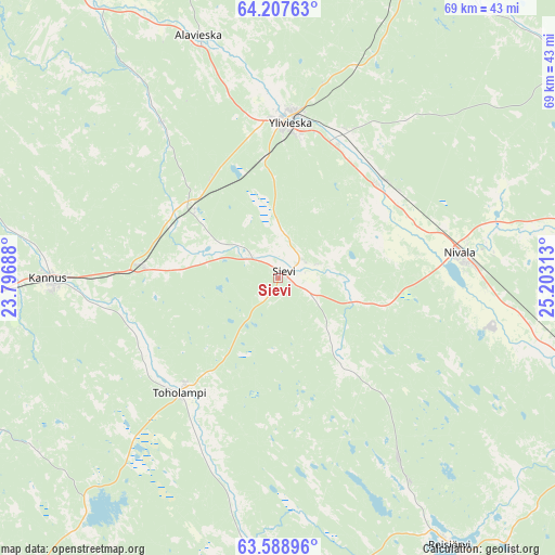
Sievi GPS coordinates[2]
63° 54' 0" North, 24° 30' 0" East
| Map corner | latitude | longitude |
|---|---|---|
| Upper-left | 64.20763°, | 23.79688° |
| Center: | 63.9°, | 24.5° |
| Lower-right: | 63.58896°, | 25.20313° |
| Map W x H: | 68.8×68.8 km | = 42.8×42.8mi |
| max Lat: | 69.90864° ⇑16% North |
| Sievi: | 63.9° |
| min Lat: | ⇓84% South 59.83333° |
| min Long | Sievi | max Long |
| 21.2° | 24.5° | 30.93276° |
| W 45.5%⇐ | ⇒54.5% E |
Elevation
Elevation of Sievi is 98 m = 322 ft, and this is 20.9 m = 69 ft above average elevation for this country.
| Max E: |
299 m = 981 ft | 37.2% |
| Sievi | 98 m 322 ft | |
| Avg. | 77.1 m = 253 ft | |
Min E: |
1 m = 3 ft | 62.8% |
See also: Finland elevation on elevation.city.
Geographical zone
Sievi is located in North temperate zone (between Tropic of Cancer and the Arctic Circle). Distance of this North polar circle is 296.2 km =184.1 mi to North.| Distance of | km | miles | from Sievi |
|---|---|---|---|
| North Pole | 2902 | 1803.2 | to North |
| Arctic Circle | 296.2 | 184.1 | to North |
| Tropic Cancer | 4499.1 | 2795.6 | to South |
| Equator | 7105 | 4414.8 | to South |


Nearby cities:
15 places around Sievi: (largest is in red/bold)
• Alavieska
31.2 km =19.4 mi,  341°
341°
• Haapajärvi
44.1 km =27.4 mi,  112°
112°
• Haapavesi
49.6 km =30.8 mi,  58°
58°
• Himanka
45 km =28 mi,  293°
293°
• Kalajoki
47.2 km =29.3 mi,  325°
325°
• Kannus
29.3 km =18.2 mi,  270°
270°
• Lestijärvi
41.4 km =25.7 mi,  169°
169°
• Lohtaja
50.5 km =31.4 mi, 285°
• Merijärvi
44.5 km =27.7 mi,  356°
356°
• Nivala
22.9 km =14.2 mi,  85°
85°
• Oulainen
43.3 km =26.9 mi,  19°
19°
• Reisjärvi
37.1 km =23.1 mi,  148°
148°
• Toholampi
19.2 km =11.9 mi,  219°
219°
• Ullava
39.1 km =24.3 mi,  211°
211°
• Ylivieska
20.5 km =12.7 mi,  6°
6°
Sources, notices
• [Note1] Compared only with cities in Finland existing in our database
• [Src1] Map data: © OpenStreetMap contributors (CC-BY-SA)
• [Src2] Other city data from geonames.org with taken over terms of usage.
• [Src3] Geographical zone / Annual Mean Temperature by Robert A. Rohde @ Wikipedia
