Villeton geodata
Villeton (Nouvelle-Aquitaine) is a populated place; located in France in Europe/Paris (GMT+2) time zone. With population of 554 people, there are 14131 cities with bigger population in this country. Compared to other cities in France, 84.4% of cities are located further ↑North; 75.4% of cities are located further →East and 91.2% of cities have higher elevation than Villeton. Note1
Administrative division(s):
- Level 1: Nouvelle-Aquitaine
- Level 2: Département du Lot-et-Garonne
- Level 3: Arrondissement de Marmande
- Level 4: Villeton


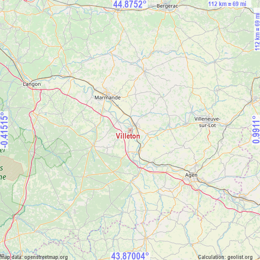
Villeton GPS coordinates[2]
44° 22' 29.208" North, 0° 17' 16.692" East
| Map corner | latitude | longitude |
|---|---|---|
| Upper-left | 44.8752°, | -0.41515° |
| Center: | 44.37478°, | 0.28797° |
| Lower-right: | 43.87004°, | 0.9911° |
| Map W x H: | 111.8×111.8 km | = 69.5×69.5mi |
| max Lat: | 51.07786° ⇑84.4% North |
| Villeton: | 44.37478° |
| min Lat: | ⇓15.6% South 41.3874° |
| min Long | Villeton | max Long |
| -5.08615° | 0.28797° | 9.52242° |
| W 24.6%⇐ | ⇒75.4% E |
Elevation
Elevation of Villeton is 27 m = 89 ft, and this is 166.7 m = 547 ft below average elevation for this country.
| Max E: |
2333 m = 7654 ft | 91.2% |
| Avg. | 193.7 m = 635 ft | |
| Villeton | 27 m = 89 ft | |
Min E: |
-1 m = -3 ft | 8.8% |
See also: France elevation on elevation.city.
Geographical zone
Villeton is located in North temperate zone (between Tropic of Cancer and the Arctic Circle). Distance of this Northern Tropic circle is 2328.1 km =1446.6 mi to South.| Distance of | km | miles | from Villeton |
|---|---|---|---|
| North Pole | 5073 | 3152.2 | to North |
| Arctic Circle | 2467.2 | 1533 | to North |
| Tropic Cancer | 2328.1 | 1446.6 | to South |
| Equator | 4934 | 3065.8 | to South |


Nearby cities:
15 places around Villeton: (largest is in red/bold)
• Aiguillon
9.4 km =5.8 mi,  153°
153°
• Birac-sur-Trec
12.4 km =7.7 mi,  352°
352°
• Bourran
9.1 km =5.7 mi,  112°
112°
• Buzet-sur-Baïse
13 km =8.1 mi,  176°
176°
• Calonges
3.7 km =2.3 mi,  269°
269°
• Caumont-sur-Garonne
11 km =6.8 mi,  309°
309°
• Clairac
7.4 km =4.6 mi,  102°
102°
• Damazan
9.4 km =5.8 mi,  185°
185°
• Fauguerolles
8.1 km =5 mi,  337°
337°
• Fauillet
5.8 km =3.6 mi,  2°
2°
• Gontaud-de-Nogaret
8.4 km =5.2 mi,  6°
6°
• Lafitte-sur-Lot
11.7 km =7.3 mi, 102°
• Le Mas-d’Agenais
6.8 km =4.2 mi, 305°
• Tonneins
2.7 km =1.7 mi,  45°
45°
• Varès
8.3 km =5.2 mi,  42°
42°
Sources, notices
• [Note1] Compared only with cities in France existing in our database
• [Src1] Map data: © OpenStreetMap contributors (CC-BY-SA)
• [Src2] Other city data from geonames.org with taken over terms of usage.
• [Src3] Geographical zone / Annual Mean Temperature by Robert A. Rohde @ Wikipedia
