Varès geodata
Varès (Nouvelle-Aquitaine) is a populated place; located in France in Europe/Paris (GMT+2) time zone. With population of 730 people, there are 11410 cities with bigger population in this country. Compared to other cities in France, 84% of cities are located further ↑North; 74.7% of cities are located further →East and 81.5% of cities have higher elevation than Varès. Note1
Administrative division(s):
- Level 1: Nouvelle-Aquitaine
- Level 2: Département du Lot-et-Garonne
- Level 3: Arrondissement de Marmande
- Level 4: Varès


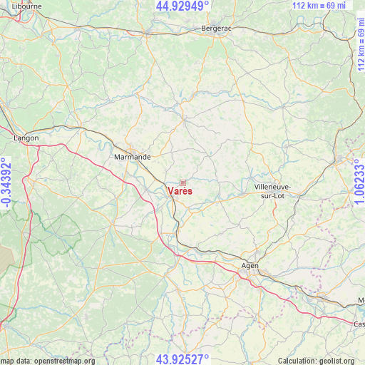
Varès GPS coordinates[2]
44° 25' 46.344" North, 0° 21' 33.156" East
| Map corner | latitude | longitude |
|---|---|---|
| Upper-left | 44.92949°, | -0.34392° |
| Center: | 44.42954°, | 0.35921° |
| Lower-right: | 43.92527°, | 1.06233° |
| Map W x H: | 111.7×111.7 km | = 69.4×69.4mi |
| max Lat: | 51.07786° ⇑84% North |
| Varès: | 44.42954° |
| min Lat: | ⇓16% South 41.3874° |
| min Long | Varès | max Long |
| -5.08615° | 0.35921° | 9.52242° |
| W 25.3%⇐ | ⇒74.7% E |
Elevation
Elevation of Varès is 51 m = 167 ft, and this is 142.7 m = 468 ft below average elevation for this country.
| Max E: |
2333 m = 7654 ft | 81.5% |
| Avg. | 193.7 m = 635 ft | |
| Varès | 51 m = 167 ft | |
Min E: |
-1 m = -3 ft | 18.5% |
See also: France elevation on elevation.city.
Geographical zone
Varès is located in North temperate zone (between Tropic of Cancer and the Arctic Circle). Distance of this Northern Tropic circle is 2334.2 km =1450.4 mi to South.| Distance of | km | miles | from Varès |
|---|---|---|---|
| North Pole | 5067 | 3148.5 | to North |
| Arctic Circle | 2461.1 | 1529.3 | to North |
| Tropic Cancer | 2334.2 | 1450.4 | to South |
| Equator | 4940.1 | 3069.6 | to South |


Nearby cities:
15 places around Varès: (largest is in red/bold)
• Birac-sur-Trec
9.6 km =6 mi,  310°
310°
• Bourran
10 km =6.2 mi,  164°
164°
• Calonges
11.2 km =7 mi,  236°
236°
• Castelmoron-sur-Lot
11.4 km =7.1 mi,  107°
107°
• Clairac
7.9 km =4.9 mi,  168°
168°
• Fauguerolles
8.8 km =5.5 mi,  279°
279°
• Fauillet
5.4 km =3.4 mi,  266°
266°
• Fongrave
12 km =7.5 mi,  15°
15°
• Gontaud-de-Nogaret
5.2 km =3.2 mi,  295°
295°
• Granges-sur-Lot
10.3 km =6.4 mi,  125°
125°
• Lafitte-sur-Lot
10.4 km =6.5 mi,  146°
146°
• Le Mas-d’Agenais
11.4 km =7.1 mi,  259°
259°
• Puymiclan
9.8 km =6.1 mi,  339°
339°
• Tonneins
5.6 km =3.5 mi,  221°
221°
• Villeton
8.3 km =5.2 mi, 222°
Sources, notices
• [Note1] Compared only with cities in France existing in our database
• [Src1] Map data: © OpenStreetMap contributors (CC-BY-SA)
• [Src2] Other city data from geonames.org with taken over terms of usage.
• [Src3] Geographical zone / Annual Mean Temperature by Robert A. Rohde @ Wikipedia
