Villefort geodata
Villefort (Occitanie) is a populated place; located in France in Europe/Paris (GMT+2) time zone. With population of 664 people, there are 12308 cities with bigger population in this country. Compared to other cities in France, 84% of cities are located further ↑North; 67.2% of cities are located further ←West and 95.2% of cities have lower elevation than Villefort. Note1
Administrative division(s):
- Level 1: Occitanie
- Level 2: Département de la Lozère
- Level 3: Arrondissement de Mende
- Level 4: Villefort


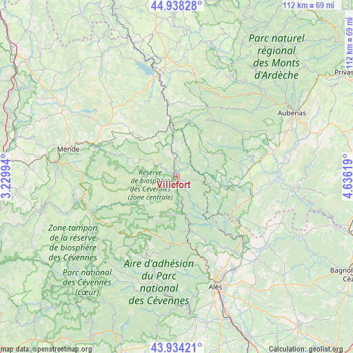
Villefort GPS coordinates[2]
44° 26' 18.24" North, 3° 55' 59.052" East
| Map corner | latitude | longitude |
|---|---|---|
| Upper-left | 44.93828°, | 3.22994° |
| Center: | 44.4384°, | 3.93307° |
| Lower-right: | 43.93421°, | 4.63619° |
| Map W x H: | 111.6×111.6 km | = 69.3×69.3mi |
| max Lat: | 51.07786° ⇑84% North |
| Villefort: | 44.4384° |
| min Lat: | ⇓16% South 41.3874° |
| min Long | Villefort | max Long |
| -5.08615° | 3.93307° | 9.52242° |
| W 67.2%⇐ | ⇒32.8% E |
Elevation
Elevation of Villefort is 597 m = 1959 ft, and this is 403.3 m = 1323 ft above average elevation for this country.
| Max E: |
2333 m = 7654 ft | 4.8% |
| Villefort | 597 m 1959 ft | |
| Avg. | 193.7 m = 635 ft | |
Min E: |
-1 m = -3 ft | 95.2% |
See also: France elevation on elevation.city.
Geographical zone
Villefort is located in North temperate zone (between Tropic of Cancer and the Arctic Circle). Distance of this Northern Tropic circle is 2335.2 km =1451 mi to South.| Distance of | km | miles | from Villefort |
|---|---|---|---|
| North Pole | 5066 | 3147.9 | to North |
| Arctic Circle | 2460.1 | 1528.6 | to North |
| Tropic Cancer | 2335.2 | 1451 | to South |
| Equator | 4941.1 | 3070.3 | to South |


Nearby cities:
15 places around Villefort: (largest is in red/bold)
• Banne
19.4 km =12.1 mi,  114°
114°
• Berrias-et-Casteljau
22.7 km =14.1 mi, 110°
• Bessèges
20.8 km =12.9 mi,  141°
141°
• Chambonas
15.7 km =9.8 mi,  98°
98°
• Chamborigaud
15.1 km =9.4 mi,  168°
168°
• Gagnières
21.4 km =13.3 mi,  133°
133°
• Génolhac
10 km =6.2 mi, 171°
• Joyeuse
24.6 km =15.3 mi,  79°
79°
• Lablachère
22.5 km =14 mi, 82°
• Le Collet-de-Dèze
21.5 km =13.4 mi,  182°
182°
• Le Martinet
24.3 km =15.1 mi,  149°
149°
• Les Assions
19.2 km =11.9 mi, 95°
• Les Vans
16.2 km =10.1 mi, 103°
• Saint-Paul-le-Jeune
20.6 km =12.8 mi,  121°
121°
• Vialas
12 km =7.5 mi,  193°
193°
Sources, notices
• [Note1] Compared only with cities in France existing in our database
• [Src1] Map data: © OpenStreetMap contributors (CC-BY-SA)
• [Src2] Other city data from geonames.org with taken over terms of usage.
• [Src3] Geographical zone / Annual Mean Temperature by Robert A. Rohde @ Wikipedia
