Villecroze geodata
Villecroze (Provence-Alpes-Côte d'Azur) is a populated place; located in France in Europe/Paris (GMT+2) time zone. With population of 1,180 people, there are 7645 cities with bigger population in this country. Compared to other cities in France, 92% of cities are located further ↑North; 90% of cities are located further ←West and 84.2% of cities have lower elevation than Villecroze. Note1
Administrative division(s):
- Level 1: Provence-Alpes-Côte d'Azur
- Level 2: Var
- Level 3: Arrondissement de Brignoles
- Level 4: Villecroze


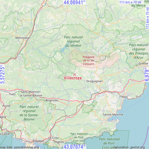
Villecroze GPS coordinates[2]
43° 34' 56.028" North, 6° 16' 33.132" East
| Map corner | latitude | longitude |
|---|---|---|
| Upper-left | 44.08941°, | 5.57275° |
| Center: | 43.58223°, | 6.27587° |
| Lower-right: | 43.07074°, | 6.979° |
| Map W x H: | 113.3×113.3 km | = 70.4×70.4mi |
| max Lat: | 51.07786° ⇑92% North |
| Villecroze: | 43.58223° |
| min Lat: | ⇓8% South 41.3874° |
| min Long | Villecroze | max Long |
| -5.08615° | 6.27587° | 9.52242° |
| W 90%⇐ | ⇒10% E |
Elevation
Elevation of Villecroze is 337 m = 1106 ft, and this is 143.3 m = 470 ft above average elevation for this country.
| Max E: |
2333 m = 7654 ft | 15.8% |
| Villecroze | 337 m 1106 ft | |
| Avg. | 193.7 m = 635 ft | |
Min E: |
-1 m = -3 ft | 84.2% |
See also: France elevation on elevation.city.
Geographical zone
Villecroze is located in North temperate zone (between Tropic of Cancer and the Arctic Circle). Distance of this Northern Tropic circle is 2240 km =1391.9 mi to South.| Distance of | km | miles | from Villecroze |
|---|---|---|---|
| North Pole | 5161.2 | 3207 | to North |
| Arctic Circle | 2555.3 | 1587.8 | to North |
| Tropic Cancer | 2240 | 1391.9 | to South |
| Equator | 4845.9 | 3011.1 | to South |


Nearby cities:
15 places around Villecroze: (largest is in red/bold)
• Ampus
9 km =5.6 mi,  72°
72°
• Aups
6.6 km =4.1 mi,  321°
321°
• Carcès
14 km =8.7 mi,  212°
212°
• Cotignac
11.8 km =7.3 mi,  239°
239°
• Draguignan
16 km =9.9 mi,  108°
108°
• Entrecasteaux
7.9 km =4.9 mi,  200°
200°
• Flayosc
11.1 km =6.9 mi,  118°
118°
• Le Thoronet
14.7 km =9.1 mi,  171°
171°
• Lorgues
12.1 km =7.5 mi,  145°
145°
• Montferrat
16.8 km =10.4 mi,  78°
78°
• Montfort-sur-Argens
17.5 km =10.9 mi,  226°
226°
• Régusse
14.2 km =8.8 mi,  305°
305°
• Salernes
4 km =2.5 mi, 238°
• Sillans-la-Cascade
7.9 km =4.9 mi,  258°
258°
• Tourtour
2.3 km =1.4 mi, 69°
Sources, notices
• [Note1] Compared only with cities in France existing in our database
• [Src1] Map data: © OpenStreetMap contributors (CC-BY-SA)
• [Src2] Other city data from geonames.org with taken over terms of usage.
• [Src3] Geographical zone / Annual Mean Temperature by Robert A. Rohde @ Wikipedia
