Villecresnes geodata
Villecresnes (Île-de-France) is a populated place; located in France in Europe/Paris (GMT+2) time zone. With population of 8,978 people, there are 1073 cities with bigger population in this country. Compared to other cities in France, 73.7% of cities are located further ↓South; 51.2% of cities are located further ←West and 76.2% of cities have higher elevation than Villecresnes. Note1
Administrative division(s):
- Level 1: Île-de-France
- Level 2: Val-de-Marne
- Level 3: Arrondissement de Créteil
- Level 4: Villecresnes


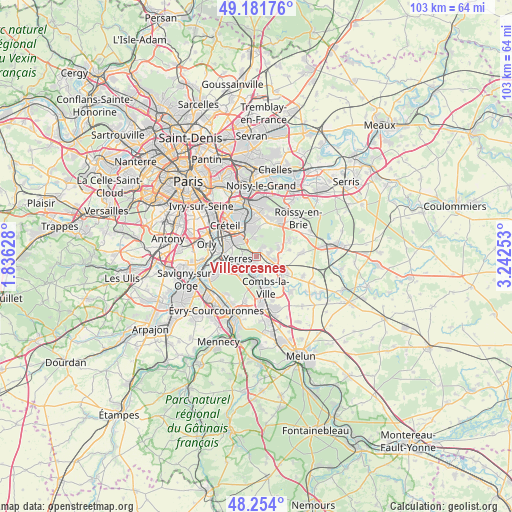
Villecresnes GPS coordinates[2]
48° 43' 12.072" North, 2° 32' 21.84" East
| Map corner | latitude | longitude |
|---|---|---|
| Upper-left | 49.18176°, | 1.83628° |
| Center: | 48.72002°, | 2.5394° |
| Lower-right: | 48.254°, | 3.24253° |
| Map W x H: | 103.2×103.2 km | = 64.1×64.1mi |
| max Lat: | 51.07786° ⇑26.3% North |
| Villecresnes: | 48.72002° |
| min Lat: | ⇓73.7% South 41.3874° |
| min Long | Villecresnes | max Long |
| -5.08615° | 2.5394° | 9.52242° |
| W 51.2%⇐ | ⇒48.8% E |
Elevation
Elevation of Villecresnes is 64 m = 210 ft, and this is 129.7 m = 426 ft below average elevation for this country.
| Max E: |
2333 m = 7654 ft | 76.2% |
| Avg. | 193.7 m = 635 ft | |
| Villecresnes | 64 m = 210 ft | |
Min E: |
-1 m = -3 ft | 23.8% |
See also: France elevation on elevation.city.
Geographical zone
Villecresnes is located in North temperate zone (between Tropic of Cancer and the Arctic Circle). Distance of this North polar circle is 1984 km =1232.8 mi to North.| Distance of | km | miles | from Villecresnes |
|---|---|---|---|
| North Pole | 4589.9 | 2852 | to North |
| Arctic Circle | 1984 | 1232.8 | to North |
| Tropic Cancer | 2811.2 | 1746.8 | to South |
| Equator | 5417.2 | 3366.1 | to South |


Nearby cities:
15 places around Villecresnes: (largest is in red/bold)
• Boissy-Saint-Léger
4 km =2.5 mi,  329°
329°
• Boussy-Saint-Antoine
3.3 km =2.1 mi,  191°
191°
• Brie-Comte-Robert
6.1 km =3.8 mi,  120°
120°
• Brunoy
4.5 km =2.8 mi,  230°
230°
• Crosne
6 km =3.7 mi,  269°
269°
• Limeil-Brévannes
4.7 km =2.9 mi,  305°
305°
• Mandres-les-Roses
2.1 km =1.3 mi,  165°
165°
• Périgny
2.9 km =1.8 mi,  155°
155°
• Quincy-sous-Sénart
5.2 km =3.2 mi,  184°
184°
• Santeny
2.6 km =1.6 mi,  72°
72°
• Servon
3.5 km =2.2 mi,  96°
96°
• Sucy-en-Brie
5.4 km =3.4 mi,  356°
356°
• Varennes-Jarcy
4.8 km =3 mi, 160°
• Yerres
3.4 km =2.1 mi, 265°
• Épinay-sous-Sénart
3.9 km =2.4 mi,  210°
210°
Sources, notices
• [Note1] Compared only with cities in France existing in our database
• [Src1] Map data: © OpenStreetMap contributors (CC-BY-SA)
• [Src2] Other city data from geonames.org with taken over terms of usage.
• [Src3] Geographical zone / Annual Mean Temperature by Robert A. Rohde @ Wikipedia
