Varennes-Jarcy geodata
Varennes-Jarcy (Île-de-France) is a populated place; located in France in Europe/Paris (GMT+2) time zone. With population of 2,019 people, there are 4751 cities with bigger population in this country. Compared to other cities in France, 72.7% of cities are located further ↓South; 51.5% of cities are located further ←West and 79% of cities have higher elevation than Varennes-Jarcy. Note1
Administrative division(s):
- Level 1: Île-de-France
- Level 2: Département de l'Essonne
- Level 3: Arrondissement d'Évry
- Level 4: Varennes-Jarcy


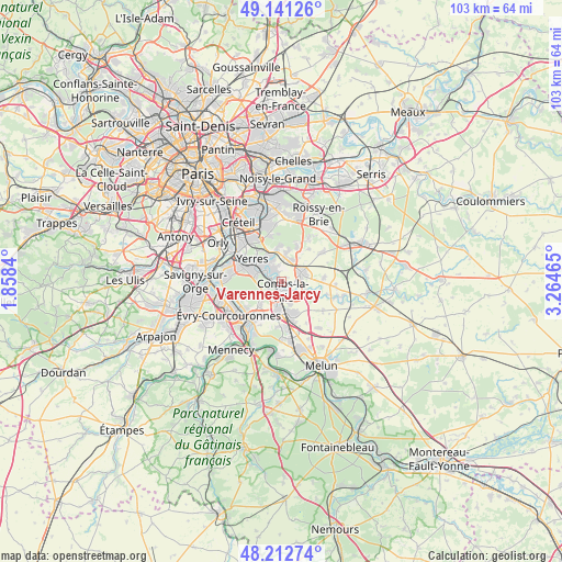
Varennes-Jarcy GPS coordinates[2]
48° 40' 44.904" North, 2° 33' 41.472" East
| Map corner | latitude | longitude |
|---|---|---|
| Upper-left | 49.14126°, | 1.8584° |
| Center: | 48.67914°, | 2.56152° |
| Lower-right: | 48.21274°, | 3.26465° |
| Map W x H: | 103.2×103.2 km | = 64.1×64.1mi |
| max Lat: | 51.07786° ⇑27.3% North |
| Varennes-Jarcy: | 48.67914° |
| min Lat: | ⇓72.7% South 41.3874° |
| min Long | Varennes-Jarcy | max Long |
| -5.08615° | 2.56152° | 9.52242° |
| W 51.5%⇐ | ⇒48.5% E |
Elevation
Elevation of Varennes-Jarcy is 57 m = 187 ft, and this is 136.7 m = 448 ft below average elevation for this country.
| Max E: |
2333 m = 7654 ft | 79% |
| Avg. | 193.7 m = 635 ft | |
| Varennes-Jarcy | 57 m = 187 ft | |
Min E: |
-1 m = -3 ft | 21% |
See also: France elevation on elevation.city.
Geographical zone
Varennes-Jarcy is located in North temperate zone (between Tropic of Cancer and the Arctic Circle). Distance of this North polar circle is 1988.6 km =1235.7 mi to North.| Distance of | km | miles | from Varennes-Jarcy |
|---|---|---|---|
| North Pole | 4594.4 | 2854.8 | to North |
| Arctic Circle | 1988.6 | 1235.7 | to North |
| Tropic Cancer | 2806.7 | 1744 | to South |
| Equator | 5412.6 | 3363.2 | to South |


Nearby cities:
15 places around Varennes-Jarcy: (largest is in red/bold)
• Boussy-Saint-Antoine
2.6 km =1.6 mi,  300°
300°
• Brie-Comte-Robert
3.9 km =2.4 mi,  67°
67°
• Brunoy
5.4 km =3.4 mi,  288°
288°
• Combs-la-Ville
1.7 km =1.1 mi,  159°
159°
• Lieusaint
5 km =3.1 mi,  191°
191°
• Mandres-les-Roses
2.8 km =1.7 mi,  336°
336°
• Moissy-Cramayel
6.6 km =4.1 mi,  153°
153°
• Périgny
2 km =1.2 mi,  346°
346°
• Quincy-sous-Sénart
2.1 km =1.3 mi,  251°
251°
• Santeny
5.4 km =3.4 mi,  9°
9°
• Servon
4.6 km =2.9 mi,  24°
24°
• Tigery
5.7 km =3.5 mi,  224°
224°
• Villecresnes
4.8 km =3 mi, 340°
• Yerres
6.6 km =4.1 mi,  310°
310°
• Épinay-sous-Sénart
3.8 km =2.4 mi, 287°
Sources, notices
• [Note1] Compared only with cities in France existing in our database
• [Src1] Map data: © OpenStreetMap contributors (CC-BY-SA)
• [Src2] Other city data from geonames.org with taken over terms of usage.
• [Src3] Geographical zone / Annual Mean Temperature by Robert A. Rohde @ Wikipedia
