Venarey-les-Laumes geodata
Venarey-les-Laumes (Bourgogne-Franche-Comté) is a populated place; located in France in Europe/Paris (GMT+2) time zone. With population of 3,447 people, there are 2818 cities with bigger population in this country. Compared to other cities in France, 51.9% of cities are located further ↓South; 71.8% of cities are located further ←West and 72.8% of cities have lower elevation than Venarey-les-Laumes. Note1
Administrative division(s):
- Level 1: Bourgogne-Franche-Comté
- Level 2: Département de la Côte-d'Or
- Level 3: Arrondissement de Montbard
- Level 4: Venarey-les-Laumes


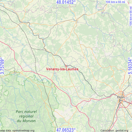
Venarey-les-Laumes GPS coordinates[2]
47° 32' 31.272" North, 4° 27' 36.792" East
| Map corner | latitude | longitude |
|---|---|---|
| Upper-left | 48.01452°, | 3.75709° |
| Center: | 47.54202°, | 4.46022° |
| Lower-right: | 47.06523°, | 5.16334° |
| Map W x H: | 105.6×105.5 km | = 65.6×65.6mi |
| max Lat: | 51.07786° ⇑48.1% North |
| Venarey-les-Laumes: | 47.54202° |
| min Lat: | ⇓51.9% South 41.3874° |
| min Long | Venarey-les-Lau | max Long |
| -5.08615° | 4.46022° | 9.52242° |
| W 71.8%⇐ | ⇒28.2% E |
Elevation
Elevation of Venarey-les-Laumes is 235 m = 771 ft, and this is 41.3 m = 135 ft above average elevation for this country.
| Max E: |
2333 m = 7654 ft | 27.2% |
| Venarey-les-Laumes | 235 m 771 ft | |
| Avg. | 193.7 m = 635 ft | |
Min E: |
-1 m = -3 ft | 72.8% |
See also: France elevation on elevation.city.
Geographical zone
Venarey-les-Laumes is located in North temperate zone (between Tropic of Cancer and the Arctic Circle). Distance of this North polar circle is 2115 km =1314.2 mi to North.| Distance of | km | miles | from Venarey-les-Laumes |
|---|---|---|---|
| North Pole | 4720.9 | 2933.4 | to North |
| Arctic Circle | 2115 | 1314.2 | to North |
| Tropic Cancer | 2680.3 | 1665.5 | to South |
| Equator | 5286.2 | 3284.7 | to South |


Nearby cities:
15 places around Venarey-les-Laumes: (largest is in red/bold)
• Alise-Sainte-Reine
2 km =1.2 mi,  103°
103°
• Blaisy-Bas
28.3 km =17.6 mi,  132°
132°
• La Roche-en-Brenil
27.7 km =17.2 mi,  229°
229°
• Montbard
12.9 km =8 mi,  314°
314°
• Pouillenay
3.9 km =2.4 mi,  171°
171°
• Pouilly-en-Auxois
31.9 km =19.8 mi, 166°
• Précy-sous-Thil
20.4 km =12.7 mi,  214°
214°
• Ravières
27.6 km =17.1 mi,  320°
320°
• Rouvray
29.7 km =18.5 mi,  243°
243°
• Saint-Rémy
16.2 km =10.1 mi, 311°
• Saulieu
33.9 km =21.1 mi, 210°
• Semur-en-Auxois
11.5 km =7.1 mi, 235°
• Sombernon
31.9 km =19.8 mi,  143°
143°
• Vitteaux
17.2 km =10.7 mi,  159°
159°
• Époisses
21.8 km =13.5 mi,  259°
259°
Sources, notices
• [Note1] Compared only with cities in France existing in our database
• [Src1] Map data: © OpenStreetMap contributors (CC-BY-SA)
• [Src2] Other city data from geonames.org with taken over terms of usage.
• [Src3] Geographical zone / Annual Mean Temperature by Robert A. Rohde @ Wikipedia
