Précy-sous-Thil geodata
Précy-sous-Thil (Bourgogne-Franche-Comté) is a populated place; located in France in Europe/Paris (GMT+2) time zone. With population of 743 people, there are 11253 cities with bigger population in this country. Compared to other cities in France, 50.2% of cities are located further ↑North; 70.6% of cities are located further ←West and 83.9% of cities have lower elevation than Précy-sous-Thil. Note1
Administrative division(s):
- Level 1: Bourgogne-Franche-Comté
- Level 2: Département de la Côte-d'Or
- Level 3: Arrondissement de Montbard
- Level 4: Précy-sous-Thil


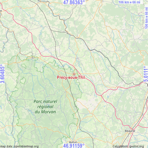
Précy-sous-Thil GPS coordinates[2]
47° 23' 23.136" North, 4° 18' 28.728" East
| Map corner | latitude | longitude |
|---|---|---|
| Upper-left | 47.86363°, | 3.60485° |
| Center: | 47.38976°, | 4.30798° |
| Lower-right: | 46.91159°, | 5.0111° |
| Map W x H: | 105.9×105.9 km | = 65.8×65.8mi |
| max Lat: | 51.07786° ⇑50.2% North |
| Précy-sous-Thil: | 47.38976° |
| min Lat: | ⇓49.8% South 41.3874° |
| min Long | Précy-sous-Thi | max Long |
| -5.08615° | 4.30798° | 9.52242° |
| W 70.6%⇐ | ⇒29.4% E |
Elevation
Elevation of Précy-sous-Thil is 333 m = 1093 ft, and this is 139.3 m = 457 ft above average elevation for this country.
| Max E: |
2333 m = 7654 ft | 16.1% |
| Précy-sous-Thil | 333 m 1093 ft | |
| Avg. | 193.7 m = 635 ft | |
Min E: |
-1 m = -3 ft | 83.9% |
See also: France elevation on elevation.city.
Geographical zone
Précy-sous-Thil is located in North temperate zone (between Tropic of Cancer and the Arctic Circle). Distance of this North polar circle is 2131.9 km =1324.7 mi to North.| Distance of | km | miles | from Précy-sous-Thil |
|---|---|---|---|
| North Pole | 4737.8 | 2943.9 | to North |
| Arctic Circle | 2131.9 | 1324.7 | to North |
| Tropic Cancer | 2663.3 | 1654.9 | to South |
| Equator | 5269.2 | 3274.1 | to South |


Nearby cities:
15 places around Précy-sous-Thil: (largest is in red/bold)
• Alise-Sainte-Reine
21.2 km =13.2 mi,  39°
39°
• Alligny-en-Morvan
23.3 km =14.5 mi,  205°
205°
• La Roche-en-Brenil
9.8 km =6.1 mi,  264°
264°
• Liernais
20.5 km =12.7 mi,  185°
185°
• Montbard
26 km =16.2 mi,  4°
4°
• Pouillenay
17.8 km =11.1 mi, 42°
• Pouilly-en-Auxois
23.4 km =14.5 mi,  127°
127°
• Quarré-les-Tombes
23.5 km =14.6 mi, 264°
• Rouvray
15.8 km =9.8 mi,  284°
284°
• Saint-Rémy
27.5 km =17.1 mi,  358°
358°
• Saulieu
13.6 km =8.5 mi, 206°
• Semur-en-Auxois
10.6 km =6.6 mi,  10°
10°
• Venarey-les-Laumes
20.4 km =12.7 mi,  34°
34°
• Vitteaux
17.6 km =10.9 mi,  87°
87°
• Époisses
16.4 km =10.2 mi,  322°
322°
Sources, notices
• [Note1] Compared only with cities in France existing in our database
• [Src1] Map data: © OpenStreetMap contributors (CC-BY-SA)
• [Src2] Other city data from geonames.org with taken over terms of usage.
• [Src3] Geographical zone / Annual Mean Temperature by Robert A. Rohde @ Wikipedia
