Ravières geodata
Ravières (Bourgogne-Franche-Comté) is a populated place; located in France in Europe/Paris (GMT+2) time zone. With population of 1,011 people, there are 8765 cities with bigger population in this country. Compared to other cities in France, 54.8% of cities are located further ↓South; 70% of cities are located further ←West and 64.4% of cities have lower elevation than Ravières. Note1
Administrative division(s):
- Level 1: Bourgogne-Franche-Comté
- Level 2: Département de l'Yonne
- Level 3: Avallon
- Level 4: Ravières


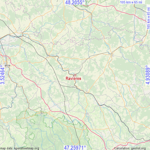
Ravières GPS coordinates[2]
47° 44' 5.1" North, 4° 13' 39.972" East
| Map corner | latitude | longitude |
|---|---|---|
| Upper-left | 48.2055°, | 3.52464° |
| Center: | 47.73475°, | 4.22777° |
| Lower-right: | 47.25971°, | 4.93089° |
| Map W x H: | 105.2×105.2 km | = 65.4×65.4mi |
| max Lat: | 51.07786° ⇑45.2% North |
| Ravières: | 47.73475° |
| min Lat: | ⇓54.8% South 41.3874° |
| min Long | Ravières | max Long |
| -5.08615° | 4.22777° | 9.52242° |
| W 70%⇐ | ⇒30% E |
Elevation
Elevation of Ravières is 191 m = 627 ft, and this is 2.7 m = 9 ft below average elevation for this country.
| Max E: |
2333 m = 7654 ft | 35.6% |
| Avg. | 193.7 m = 635 ft | |
| Ravières | 191 m = 627 ft | |
Min E: |
-1 m = -3 ft | 64.4% |
See also: France elevation on elevation.city.
Geographical zone
Ravières is located in North temperate zone (between Tropic of Cancer and the Arctic Circle). Distance of this North polar circle is 2093.6 km =1300.9 mi to North.| Distance of | km | miles | from Ravières |
|---|---|---|---|
| North Pole | 4699.5 | 2920.1 | to North |
| Arctic Circle | 2093.6 | 1300.9 | to North |
| Tropic Cancer | 2701.7 | 1678.8 | to South |
| Equator | 5307.6 | 3298 | to South |


Nearby cities:
15 places around Ravières: (largest is in red/bold)
• Alise-Sainte-Reine
29.2 km =18.1 mi,  138°
138°
• Ancy-le-Franc
6.6 km =4.1 mi,  313°
313°
• Châtillon-sur-Seine
29.3 km =18.2 mi,  61°
61°
• Joux-la-Ville
30.1 km =18.7 mi,  245°
245°
• Laignes
15.8 km =9.8 mi,  40°
40°
• Lézinnes
12.8 km =8 mi, 305°
• Montbard
14.9 km =9.3 mi,  146°
146°
• Noyers
18 km =11.2 mi,  255°
255°
• Saint-Rémy
12 km =7.5 mi, 154°
• Semur-en-Auxois
29.1 km =18.1 mi,  164°
164°
• Tanlay
16.2 km =10.1 mi,  318°
318°
• Tonnerre
23.3 km =14.5 mi, 305°
• Venarey-les-Laumes
27.6 km =17.1 mi, 140°
• Épineuil
24 km =14.9 mi, 309°
• Époisses
25.7 km =16 mi,  188°
188°
Sources, notices
• [Note1] Compared only with cities in France existing in our database
• [Src1] Map data: © OpenStreetMap contributors (CC-BY-SA)
• [Src2] Other city data from geonames.org with taken over terms of usage.
• [Src3] Geographical zone / Annual Mean Temperature by Robert A. Rohde @ Wikipedia
