Vitteaux geodata
Vitteaux (Bourgogne-Franche-Comté) is a populated place; located in France in Europe/Paris (GMT+2) time zone. With population of 1,161 people, there are 7758 cities with bigger population in this country. Compared to other cities in France, 50.1% of cities are located further ↑North; 72.4% of cities are located further ←West and 82.5% of cities have lower elevation than Vitteaux. Note1
Administrative division(s):
- Level 1: Bourgogne-Franche-Comté
- Level 2: Département de la Côte-d'Or
- Level 3: Arrondissement de Montbard
- Level 4: Vitteaux


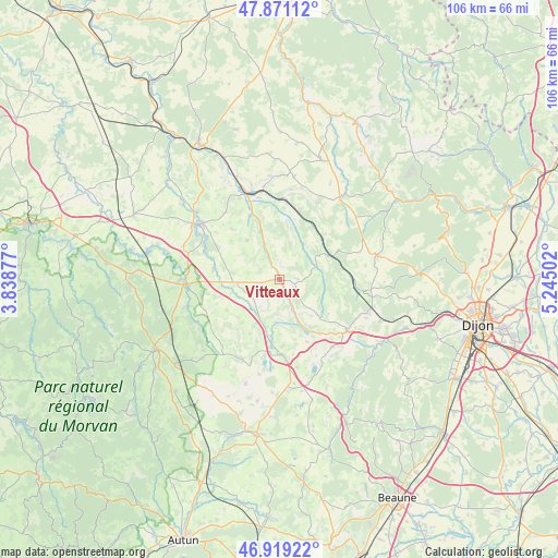
Vitteaux GPS coordinates[2]
47° 23' 50.352" North, 4° 32' 30.84" East
| Map corner | latitude | longitude |
|---|---|---|
| Upper-left | 47.87112°, | 3.83877° |
| Center: | 47.39732°, | 4.5419° |
| Lower-right: | 46.91922°, | 5.24502° |
| Map W x H: | 105.8×105.8 km | = 65.7×65.7mi |
| max Lat: | 51.07786° ⇑50.1% North |
| Vitteaux: | 47.39732° |
| min Lat: | ⇓49.9% South 41.3874° |
| min Long | Vitteaux | max Long |
| -5.08615° | 4.5419° | 9.52242° |
| W 72.4%⇐ | ⇒27.6% E |
Elevation
Elevation of Vitteaux is 316 m = 1037 ft, and this is 122.3 m = 401 ft above average elevation for this country.
| Max E: |
2333 m = 7654 ft | 17.5% |
| Vitteaux | 316 m 1037 ft | |
| Avg. | 193.7 m = 635 ft | |
Min E: |
-1 m = -3 ft | 82.5% |
See also: France elevation on elevation.city.
Geographical zone
Vitteaux is located in North temperate zone (between Tropic of Cancer and the Arctic Circle). Distance of this North polar circle is 2131.1 km =1324.2 mi to North.| Distance of | km | miles | from Vitteaux |
|---|---|---|---|
| North Pole | 4737 | 2943.4 | to North |
| Arctic Circle | 2131.1 | 1324.2 | to North |
| Tropic Cancer | 2664.2 | 1655.5 | to South |
| Equator | 5270.1 | 3274.7 | to South |


Nearby cities:
15 places around Vitteaux: (largest is in red/bold)
• Alise-Sainte-Reine
16.2 km =10.1 mi,  344°
344°
• Blaisy-Bas
15.1 km =9.4 mi,  101°
101°
• Fleurey-sur-Ouche
25.7 km =16 mi,  111°
111°
• La Roche-en-Brenil
27.4 km =17 mi,  266°
266°
• Liernais
28.9 km =18 mi,  222°
222°
• Mâlain
20.9 km =13 mi, 112°
• Pouillenay
13.4 km =8.3 mi, 335°
• Pouilly-en-Auxois
15 km =9.3 mi,  175°
175°
• Précy-sous-Thil
17.6 km =10.9 mi, 267°
• Sainte-Marie-sur-Ouche
22.8 km =14.2 mi,  122°
122°
• Saulieu
27 km =16.8 mi,  241°
241°
• Semur-en-Auxois
18.4 km =11.4 mi,  301°
301°
• Sombernon
16 km =9.9 mi,  127°
127°
• Velars-sur-Ouche
28.7 km =17.8 mi, 107°
• Venarey-les-Laumes
17.2 km =10.7 mi, 339°
Sources, notices
• [Note1] Compared only with cities in France existing in our database
• [Src1] Map data: © OpenStreetMap contributors (CC-BY-SA)
• [Src2] Other city data from geonames.org with taken over terms of usage.
• [Src3] Geographical zone / Annual Mean Temperature by Robert A. Rohde @ Wikipedia
